Saltvik
| coat of arms | map |
|---|---|

|

|
| Basic data | |
| State : |
|
| Landscape : | Åland |
| Administrative community : | Åland Country |
| Geographical location | 60 ° 17 ′ N , 20 ° 3 ′ E |
| Surface: | 1,166.79 km² |
| of which land area: | 152.09 km² |
| of which inland waterways: | 6.99 km² |
| of which sea area: | 1,007.71 km² |
| Residents : | 1,858 (Dec. 31, 2018) |
| Population density : | 12.2 inhabitants / km² |
| Municipality number : | 736 |
| Language (s) : | Swedish |
| Website : | www.saltvik.ax |
Saltvik is a municipality in the autonomous Finnish province ( Finnish : Lääni ) Åland .
location and size
It is located in the northeast of Åland's main island, Fasta Åland, bordering the municipalities of Finström in the west and Sund in the south. Saltvik has 1858 inhabitants (as of December 31, 2018) and covers an area of 159.08 square kilometers. As in all of Åland, Swedish is the official language. Åland's highest point, Orrdalsklint , which is 129 meters high , is in Saltvik Municipality. The municipality includes the places Antböle, Bertby, Boksö, Borgboda, Daglösa, Främmanby, Germundö, Haga, Haraldsby, Hjortö, Hullby, Kuggböle, Kvarnbo, Laby, Lagmansby, Lavsböle, Lavö, Liby, Långbergsöda, Näs, Ovan, Ryssböle, Ryssö, Saggö, Sonnröda, Strömma, Syllöda, Sålis, Tengsöda, Toböle, Vassböle, Åsgårda and Ödkarby.
history
The first written mention of Saltvik dates back to the year 1322. The name suggests that the place was an important trading center (Swedish vikort ), especially for the salt trade. The church of Saltvik was built to parts of the 13th century.
Attractions
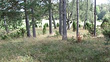
The place Kvarnbo is known because of the hill fort Borge from the younger Iron Age . With an area of around 3.0 hectares, it is the largest of six castles in Åland. In the vicinity of the Borgboda courtyard, which is much visited because of the Idas stuga building , there are four grave fields, where archaeological investigations have made finds from the Bronze Age and the Younger Iron Age. The largest burial ground, Ängisbacken , contains 65 graves, and the second largest, Gammelgårdshägnaden , consists of 63 burial sites.
Sons and daughters of the church
- Pehr Henrik Nordgren (1944–2008), composer
- Atos Wirtanen (1906–1979), politician, journalist and author
References
- ↑ Maanmittauslaitos (Finnish land surveying office): Suomen pinta-alat kunnittain January 1, 2010 (PDF; 199 kB)
- ↑ Statistical Office Finland: Table 11ra - Key figures on population by region, 1990-2018
- ^ Matts Dreijer: The History of the Åland People. Vol. I: 1. Almqvist & Wiksell, Stockholm 1986. pp. 145-146.
- ↑ Kjell Ekström: Åland - Skärgård i Östersjön , p. 68. Mariehamn 2006
Web links
- www.saltvik.ax - the municipality's website


