Jomala
| coat of arms | map |
|---|---|

|

|
| Basic data | |
| State : |
|
| Landscape : | Åland |
| Administrative community : | Åland Country |
| Geographical location | 60 ° 9 ′ N , 19 ° 58 ′ E |
| Surface: | 687.05 km² |
| of which land area: | 142.55 km² |
| of which inland waterways: | 0.82 km² |
| of which sea area: | 543.68 km² |
| Residents : | 5,032 (Dec 31, 2018) |
| Population density : | 35.3 inhabitants / km² |
| Municipality number : | 170 |
| Language (s) : | Swedish |
| Website : | http://www.jomala.ax |
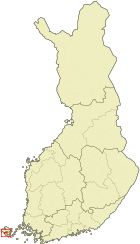
Jomala is a municipality in the autonomous Finnish province ( Finnish : Lääni ) Åland . It is located in the center of Åland's main island, Fasta Åland, just north of the provincial capital Mariehamn . Jomala has 5032 inhabitants (as of December 31, 2018) and an area of 143.37 km². Jomala is Åland's most populous rural municipality. As in all of Åland, Swedish is the official language.
History and sights
Signs of Stone Age dwellings have been found in the village of Jettböle (2500–2000 BC); in Borgberget a burial ground and the remains of a find Wallburg from the time of the Vikings.
The Church of Jomala was built around 1280, so it is probably the oldest church in Finland. It received its present form through renovations in the 19th century. In the lower part of the tower there are wall paintings. B. the parable of the prodigal son and the Last Judgment - from the 13th century, which could possibly be the only Romanesque wall paintings in all of Finland. In front of the church a memorial commemorates the sailors who perished at sea. Another monument in front of the church is dedicated to the emigrants who left the Åland Islands due to material need.
Behind the church is an extensive burial ground with 130 burial mounds from the Iron Age and the foundations of several buildings from the Middle Ages. The area, through which a hiking trail with information boards leads, was first scientifically investigated in 1910 and mapped by Björn Cederhvarf.
At the highest point of the Dahlsberg, Russia built the Kungsö battery during the First World War, which included barracks for around 100 soldiers. In March 1918, the Russians withdrew from the battery after German troops landed on the island. The battery was destroyed by German soldiers and Finnish workers in 1919.
Place name
The origin and meaning of the name Jomala have not been conclusively clarified. The suffix –ala is generally traced back to a Nordic origin, where it denotes something elongated, whereby in the case of Jomala the ridge on which the church of the community stands today is probably meant. The first syllable Jom may be related to the place names Jom and Jumkil in Uppland, Sweden . According to another theory, it represents a contraction of Nordic jor ("horse") and hem ("yard, good"). A combination of jor and mala ("beaches") is also being discussed.
Another theory derives the name from a Scandinavian deity "Jom", the suffix -ala is added to the Gothic word ahls ("sanctuary"). Finally, there is the perception that the place derives its name from the Finnish word Jumala ("God"). This theory is supported by the derivation of Jumne, a town in Jomsgau, the home of the Jomswikings , which, according to Grimm, should come from the North Germanic language area and is translated as sandbank or sand island , which is probably true for Wollin. To what extent this geneaology also applies to Jomala can be seen subjectively. This at least proves the existence of the root word in Germanic and corresponds to the archaeological evidence of a Viking castle. A god Yom may therefore refer to the Swedish Viking and the legends resulting from it, who led the Jom Vikings. The many figurines that were found in Jettbölle on Jomala also speak for a shrine. On the one hand, the fact that there are no settlement names with the component Jumala in Finland speaks against the Finnish interpretation, but only natural names. In addition, Ålanders in particular insist that in the whole of Åland, with the exception of the late island name Koskenpää, there are no place names that can be clearly traced back to a Finnish origin. The attempt to establish Finnish etymologies and thus suggest a possible prehistoric Finnish settlement of the archipelago is understood as a political maneuver to historically legitimize Åland's affiliation to Finland.
politics
A new local council for Jomala was elected in the local elections held at the same time as the 2015 Åland parliamentary elections. The Moderate Collection became the strongest party for Åland, well ahead of the Åland Center .
flora
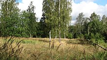
The Ramsholmen nature reserve is located in the Jomala municipality. This is home to numerous rare plants, including bear's garlic and orchids . In spring, the area is the flower of liverwort , wood anemones and cowslips coined.
Culture
One of the annual cultural events in Jomala is the traditional peasant wedding at the beginning of July, which begins with a wedding procession in the style of the 19th century from the church of Jomala to the Berghydan youth center. For the fortieth anniversary in 2007, the procession ended at Ulfsby farm. In September, the harvest festival with a large fair takes place in the center of Jomalaby.
economy
Most of the inhabitants of the 32 villages of Jomala are now employed in the service sector , especially in tourism , although agriculture continues to be of great importance. Jomala is also home to the main island's only airport. The Åland Post Post Company is also headquartered in the village of Sviby in Jomala.
In the community there is almost full employment , the unemployment rate was officially recorded in January 2007 at 1.6 percent.
Surroundings
A few kilometers north of Jomala, the 70 m high Ingbyberg rises in a wooded rocky landscape, on which an observation tower has been built. In addition to some graves from the Bronze Age, there are several well-known natural monuments on the slopes of the mountain , e. B. the 11 m deep, legendary cave Trollkyrka , in which in the 17th century people hid during a war under King Karl XII and are said to have lived for a long time. Not far from there is the narrow Storbergsgatan gorge , which is reminiscent of a narrow street and whose name translates as "Großbergstraße". The Ice Age scree field Knapplarna extends near the observation tower . It originated around 7000 years ago when the sea level reached this far and the stones were polished smooth by the waves. A similar ice age scree field is located in the immediate vicinity of the Bomarsund fortress in Sund.
Sons and daughters
- Frej Liewendahl (1902–1966), middle-distance runner
- Janne Holmén (* 1977), long-distance runner
Web links
References
- ↑ Maanmittauslaitos (Finnish land surveying office): Suomen pinta-alat kunnittain January 1, 2010 (PDF; 199 kB)
- ↑ Statistical Office Finland: Table 11ra - Key figures on population by region, 1990-2018
- ↑ a b Heiner Labonde: Finland - Åland Islands. Offenbach 2011, p. 135.
- ↑ Heiner Labonde: Finland - Åland Islands. Offenbach 2011, p. 131.
- ^ Matts Dreijer: The History of the Åland People . Volume I. 1. Almqvist & Wiksell, Stockholm 1986, pp. 144-145.
- ↑ Aino Naert: Finns det teoforma ortnamn i Finland? In: Nordisk hedendom. Et symposium. Odense 1991, pp. 245-259, 251.
- ^ Matts Dreijer: The History of the Åland People . Volume I: 1. Almqvist & Wiksell, Stockholm 1986, pp. 47, 154-155.
- ↑ Lagtings- och kommunalvalet 2015. ÅSUB Statistics, pp. 41–46 , accessed on June 11, 2019 (Swedish).
- ↑ Lagtings- och kommunalvalet 2011 ( Wayback Machine ) Statistics 7: 2011 (ÅSUB), p. 5
- ↑ ( page no longer available , search in web archives ) kuntalehti.fi
- ↑ Kjell Ekström: Åland - skärgård i Östersjön. Mariehamn 2006, p. 47.
- ↑ Kjell Ekström: Åland - skärgård i Östersjön. Mariehamn 2006, p. 46.


