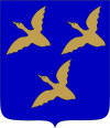
Föglö
| coat of arms | map |
|---|---|

|

|
| Basic data | |
| State : |
|
| Landscape : | Åland |
| Administrative community : | Åland archipelago |
| Geographical location | 60 ° 2 ′ N , 20 ° 23 ′ E |
| Surface: | 1,869.09 km² |
| of which land area: | 134.78 km² |
| of which inland waterways: | 0.31 km² |
| of which sea area: | 1,734.00 km² |
| Residents : | 534 (December 31, 2018) |
| Population density : | 4 people / km² |
| Municipality number : | 062 |
| Language (s) : | Swedish |
| Website : | www.foglo.ax |
Föglö is a municipality in the autonomous Finnish province of Åland . The municipality includes numerous islands in southern Åland, east of Lemland and southwest of Sottunga . Föglö has 534 inhabitants (as of December 31, 2018) and a land area of 134.78 square kilometers. As in all of Åland, Swedish is the official language.
history
Föglö was first mentioned around 1250 as Fyghelde , which is probably due to the Old High German fogalweida , " bird pasture ". The second part of the word was slurred to ö , Swedish for "island," over time . The main shipping route between Sweden and present-day Finland has led through the waters of Föglö since the Viking times, as it is today. The first pilot station in Finland was located in the village of Flisö . During the Great Northern War , several sea battles took place near Flisö.
Attractions
The main attraction of Föglö is the medieval church of Maria Magdalena. It was built at the beginning of the 16th century and converted into a cruciform church from 1859 to 1861. Another attraction is the customs warehouse building from 1826, which today houses the Föglös Museum.
economy
Föglö's main industries are traditionally agriculture , fish farming and fishing . Today, however, tourism is also very important, and around half of the community's residents are employed in the service sector.
traffic
There are ferry connections from Svinö in Lumparland directly to the main island of Föglö to the village of Degerby. The village of Överö in the far north of the municipality is also approached by the ferry between Galtby in Korpo and Långnäs in Lumparland. The main inhabited islands within the municipality are connected by bridges.
Localities
The municipalities include Björkör, Björsboda, Bråttö, Brändö, Bänö, Degerby, Finholma, Flisö, Granboda, Hastersboda, Horsholma, Hummersö, Jyddö, Järsö, Kallsö, Klåvskär, Nötö, Överö, Sonnboda, Stogentorpa, Sommarö, Sonnboda and Ulversö.
Web links
- www.foglo.ax - home page of the municipality
- www.alandstrafik.ax - ferry connections and timetables for small ferries within Åland
Individual evidence
- ↑ Maanmittauslaitos (Finnish land surveying office): Suomen pinta-alat kunnittain January 1, 2010 (PDF; 199 kB)
- ↑ Statistical Office Finland: Table 11ra - Key figures on population by region, 1990-2018
- ^ Matts Dreijer: The History of the Åland People. Vol. I: 1. Almqvist & Wiksell, Stockholm 1986. p. 148.
