
Faw (Iraq)
| Faw | |||
|---|---|---|---|
| location | |||
|
|||
| Coordinates | 29 ° 59 ′ N , 48 ° 28 ′ E | ||
| Country |
|
||
| Governorate | Basra | ||
| District | Faw | ||
| Basic data | |||
| height | 2 m | ||
| surface | 3775 km² | ||
| Residents | 105,080 (2005-01-01) | ||
| Population density | 27.8 inhabitants / km² | ||
 |
|||


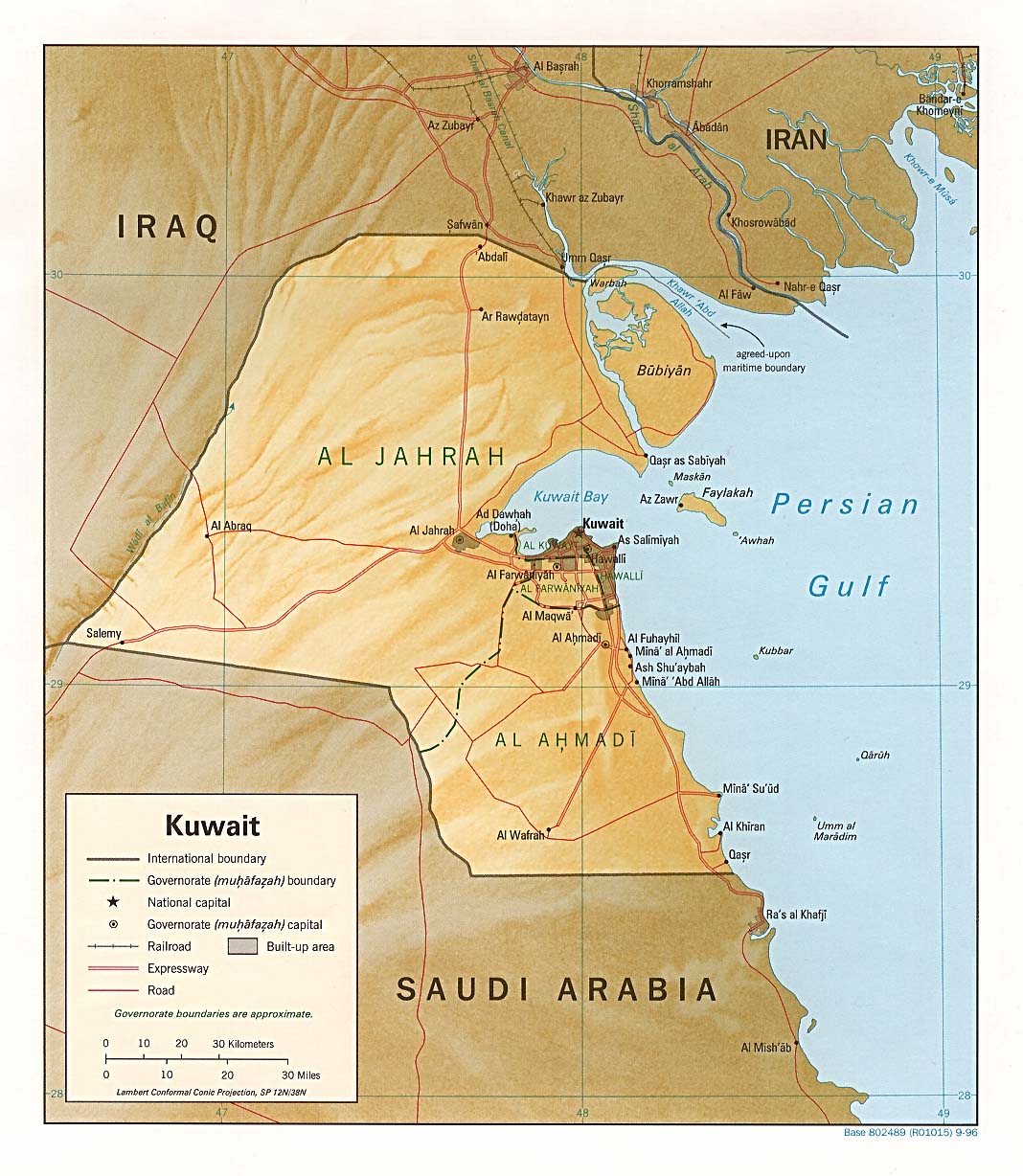
Faw ( Arabic الفاو, DMG al-Fāw ; Alternative spelling Fao or Fau ) is a city in Iraq with 105,080 inhabitants (as of January 1, 2005) on the peninsula of the same name, which protrudes east of Umm Qasr between Kuwait and Iran into the Persian Gulf . The city is located directly on the Shatt al-Arab waterway , which forms the border with Iran.
The al-Faw peninsula is Iraq's only access to the sea and is therefore of great strategic importance. As a port city, however, it is not the city of Faw, but rather Umm Qasr on the western side of the peninsula with the country's only deep-water port.
history
During World War I , the British landing at Fao was the opening battle of the Mesopotamian front . The Fao fortress, which was strategically located at the mouth of the Shatt al-Arab, was captured by British troops. In the First Gulf War between Iran and Iraq from 1980 to 1988, the Faw peninsula was fiercely contested. It was conquered by Iran in February 1986 and recaptured by Iraq in April 1988, which prompted the construction of the Baghdad al-Faw Palace . In the fighting for the island, up to 170,000 soldiers are said to have died on both sides. Chemical warfare agents were used during the reconquest, according to UN investigations .
In the third Gulf War at the beginning of 2003, the Faw peninsula fell into the hands of attackers from the USA and Great Britain after just a few days .