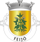
Feijó (Almada)
| Feijó | ||||||
|---|---|---|---|---|---|---|
|
||||||
| Basic data | ||||||
| Region : | Lisboa | |||||
| Sub-region : | Lisbon metropolitan area | |||||
| District : | Setubal | |||||
| Concelho : | Almada | |||||
| Freguesia : | Laranjeiro e Feijó | |||||
| Coordinates : | 38 ° 39 ′ N , 9 ° 10 ′ W | |||||
| Postal code : | 2810-xxx | |||||
Feijó is a district and a former municipality of the Portuguese city of Almada .
history
The place was first documented in the 16th century. Feijó became an independent administrative municipality in 1993.
With the territorial reform of 2013 , the municipality of Feijó was dissolved and merged with the municipality of Laranjeiro .
administration
Feijó was a municipality ( freguesia ) in the district ( concelho ) of Almada , in the district of Setúbal . The community had 18,482 inhabitants and an area of 4.20 km² (as of June 30, 2011).
The municipality of Feijó consisted only of the district of the same name.
In the course of the administrative reorganization of September 29, 2013 , Feijó was merged with Laranjeiro to form the new municipality União das Freguesias de Laranjeiro e Feijó .
Web links
- Entry Feijós in the Mapas de Portugal
Individual evidence
- ↑ www.ine.pt - indicator resident population by place of residence and sex; Decennial in the database of the Instituto Nacional de Estatística

