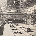
Laluque mines light railway
| Laluque mines light railway | ||||||||||||||||||||||||||||||||||||||||
|---|---|---|---|---|---|---|---|---|---|---|---|---|---|---|---|---|---|---|---|---|---|---|---|---|---|---|---|---|---|---|---|---|---|---|---|---|---|---|---|---|
|
Krauss locomotive from the Laluque mines with approx. 20 hp
| ||||||||||||||||||||||||||||||||||||||||
|
Route (--- dashed line: " Decauville actuel" ), 1917
| ||||||||||||||||||||||||||||||||||||||||
| Route length: | First 1.3 km, later 6.5 km, finally 5 km |
|||||||||||||||||||||||||||||||||||||||
| Gauge : | 600 mm ( narrow gauge ) | |||||||||||||||||||||||||||||||||||||||
|
||||||||||||||||||||||||||||||||||||||||
The Laluque mines light railway was a narrow-gauge railway operated by the Laluque lignite mines in France. Initially, it led from the underground lignite mines to the Laluque-Boos standard-gauge railway station, 1.3 km away, and later via a hairpin at Chalet Lasalle to the Laluque-Midi station, 6.5 km away, whereupon the route was finally implemented in 1917 by building a shortcut Miou and Payot was shortened to 5.0 km.
history
Since 1859, the first mining concession for lignite mining was awarded in Le Larquier, a district of the municipality of Laluque. The lignite was mined by hand and used locally as fuel. It was not until 1916 that significant exploitation began. In 1920 the Larquier concession merged with the Laluque concession.
The Lamothe - Dax section of the Bordeaux-Saint-Jean - Irun line of the Cie du Midi , which was opened on December 12, 1854, ran 4 km from the village through the municipality of Laluque. The light railway was, presumably with portable Decauville - track panels laid on the road from the mine to the station Laluque-Midi. Tunnel mining appears to have ceased in the early 1920s.
From 1926, an open-cast brown coal mine with steam shovel excavators was operated east of the disused mine in the Berdot quarry. These filled the carts that drove on a flying track parallel to the cutting front. The open pit mine at Berdot was abandoned after the opening of a new operation in the northwest of the concession, closer to the new lignite distillation plant.
At the Laluque-Midi station, a wooden loading station was built for reloading the lignite from the field railway with a gauge of 600 mm into the standard-gauge freight wagons.
On the route shaped like the number '2' by the hairpin, only about 40 tons of lignite could be transported per day, although a freight volume of 100 tons per day was planned. Therefore, in 1917 a shortcut was built at Miou and Payot, which shortened the route by about 1.5 km and increased the transport volume to 80-90 tons per day.
Coal gasification
Around 1925, a modern was in Laluque coal gasification plant built in the brown coal at high temperatures to produce town gas and synthesis gas has been processed. The ovens in this system were loaded from above with special trucks.
Web links
Individual evidence
- ↑ Le génie Civil magazine , 1926.
- ↑ Inventaire des Réseaux Spéciaux et Particuliers: Réseau des mines de lignite de Laluque, IRSP n ° 40142.1. October 21, 2016.
- ↑ Ministère de la Guerre. Section économique de la 18e region. Comité (consultatif) d'action économique: Enquête sur la reprise et le développement de la vie industrial dans la région landaise. 2nd edition, Bordeaux, 1917. pp. 333-338.
- ↑ Laluque / Saint-Girons-en-Marensin.
- ↑ Edmond Marcotte: Chimie Industrielle - La carbonization des lignites a basse temperature aux Mines de Laluque (Landes). Le Genie Civil, Samedi 13 Mars 1926.
Coordinates: 43 ° 49 ′ 16 ″ N , 0 ° 58 ′ 2.6 ″ W.


