Felderhof (Ettringen)
|
Felderhof
Ettringen municipality
Coordinates: 48 ° 5 ′ 57 ″ N , 10 ° 37 ′ 47 ″ E
|
|
|---|---|
| Height : | 590 m above sea level NN |
| Postal code : | 86833 |
| Area code : | 08249 |
|
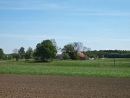
The Felderhof homestead near Ettringen
|
|
Felderhof is a part of the Upper Swabian community Ettringen in the Unterallgäu district in Swabia .
geography
Felderhof is about two kilometers west of the main town of Ettringen. The district is connected to the main town via the MN 6 district road.
history
When Felderhof was founded is unknown. It has certainly been documented since 1546. It is believed to have died out during the Thirty Years War and was not re-inhabited. The present homestead dates from the 19th century.
Web links
Commons : Felderhof - Collection of pictures, videos and audio files
literature
- Hermann Haisch (Ed.): Landkreis Unterallgäu . Memminger Zeitung Verlagsdruckerei, Memmingen 1987, ISBN 3-9800649-2-1 , p. 998 .

