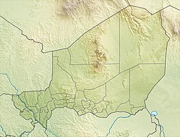
Central Niger wetland
|
Wetland in the middle Niger
zone humide du moyen Niger |
||
| location | Dosso region , Niger | |
| surface | 521.8 km² | |
| Geographical location | 12 ° 8 ' N , 3 ° 11' E | |
|
|
||
| Setup date | June 17, 2001 | |
The wetland on central Niger ( French : Zone humide du moyen Niger ) is a wetland in the Dosso region in Niger . It is protected under the Ramsar Convention .
Location and protection status
The wetland lies on the left bank of the Niger River . It extends over parts of the communes of Sambéra in the Dosso department and Tanda in the Gaya department , both of which belong to the Dosso region. In the south it borders on another Ramsar area, the wetland on central Niger II .
The wetland on central Niger covers an area of 52,180 hectares and was placed under protection on June 17, 2001 under the Ramsar Convention. It comprises a section of the Niger River and its floodplains, with ponds that are partly only temporarily available, including the mouth of the Walwal dry valley in the Niger.
fauna and Flora
The most important bird species observed in the wetland are the teal duck , the widow whistle goose , the little egret , the ruff , the spur goose and the humped goose . The fish species include Alestes baremoze , Citharinus citharus , Clarias anguillaris , Distichodus brevipinnis , Heterobranchus bidorsalis , Heterotis niloticus , Hyperopisus bebe , Polypterus senegalus and Protopterus annectens .
The most notable plants include the Doum palm species Hyphaene thebaica , the sweet grass species Anthephora nigritana and Echinochloa stagnina , the mimosa species Mimosa pigra and the white water lily .
Settlements
The main settlements in the area include:
- the villages of Bangaga Rimaibe, Koulou, Kounkouroutou Koira, Larrey, Ounna and Yoldé in the rural municipality of Sambéra as well
- the villages of Albarkaïzé and Sia in the rural municipality of Tanda.
See also
literature
- Mahamane Ali, Diouf Abdoulaye, Ambouta Karimou Jean Marie, Saadou Mahamane, Elhadji Maman Saadou, Wata Issoufou, Ichaou Aboubacar, Abassa Issaka: Dynamique spatio-temporelle de l'écosystème du Site Ramsar du Moyen 1: casbark de la mare de Albarké . In: Revue Française de Photogrammétrie et de Télédétection . No. 187–188 , January 2007, pp. 32-43 ( researchgate.net ).
Web links
- Zone humide du moyen Niger. In: Ramsar Sites Information Service. April 13, 2018(English).
Individual evidence
- ↑ a b National Repertoire des Localités (ReNaLoc). (RAR; 11.3 MB) Institut National de la Statistique de la République du Niger, July 2014, pp. 143–146, 162–164 , accessed on August 7, 2015 (French).
- ↑ a b Système de zones humides de la region du fleuve. (PDF) map. Direction de la Faune, de la Pêche et de la Pisciculture, March 2001, accessed on March 10, 2019 (French).
- ^ Zone humide du moyen Niger. In: Ramsar Sites Information Service. April 13, 2018, accessed March 25, 2019 .
- ↑ Ali Laouel Abagana, Issa Mariama Ali Omar: Zone du moyen Niger humid. Fiche descriptive Ramsar. (PDF) In: Ramsar Sites Information Service. April 13, 2018, accessed March 25, 2019 (French).
