Fiddler's Island Stream
| Fiddler's Island Stream | ||
|
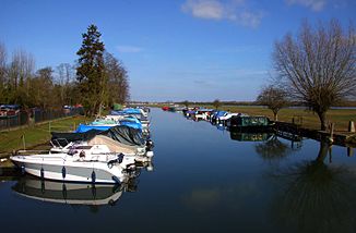
The Fiddler's Island Stream with the Thames in the background |
||
| Data | ||
| location | England | |
| River system | Thames | |
| source | in Oxford from Castle Mill Stream 51 ° 45 ′ 39 ″ N , 1 ° 16 ′ 35 ″ W |
|
| muzzle | in the Sheepwash Channel coordinates: 51 ° 45 ′ 20 " N , 1 ° 16 ′ 18" W 51 ° 45 ′ 20 " N , 1 ° 16 ′ 18" W.
|
|
The Fiddler's Island Stream is a tributary of the Thames near Oxford . The Fiddler's Island Stream branches off from Castle Mill Stream at the northwest end of Cripley Meadow and flows, partly only separated from the main river by a narrow strip of land, in a southerly direction until it flows into the Sheepwash Channel .
