
L'Aquila Airport
| L'Aquila-Preturo Airport “Aeroporto dei Parchi” |
|
|---|---|

|
|
| Characteristics | |
| ICAO code | LIAP |
| IATA code | QAQ |
| Coordinates | |
| Height above MSL | 674 m (2211 ft ) |
| Transport links | |
| Distance from the city center | 8 km west of L'Aquila |
| Street | A24 , SS80, SP33 |
| train | L'Aquila train station |
| Local transport | Bus, taxi |
| Basic data | |
| opening | 1968 |
| operator | AVDA SpA |
| Terminals | 1 |
| Start-and runway | |
| 18/36 | 1409 m × 26 m asphalt |
The airport L'Aquila-Preturo ( it .: Aeroporto di L'Aquila-Preturo “Aeroporto dei Parchi” ) is located in the Italian region of Abruzzo , around eight kilometers west-northwest of the city center of L'Aquila , near the village of Preturo. The airfield is used by general aviation and regional airlines.
Infrastructure
The airfield has an asphalt runway (18/36) that runs in a north-south direction and is around 1400 meters long . To the east of the runway there is an apron with a small reception building , to the south-east there is an air rescue base .
history
The airfield was created from 1968 and operated by the local aero club until 2009. From April 2009, after a severe earthquake , the airfield served as a base for the Italian civil defense . The airfield was slightly expanded for the G8 summit organized in L'Aquila in July 2009 . The city then transferred the airport to a new airport operator from the Aosta Valley (AVDA) with the intention of bringing charter and regional airlines to L'Aquila. Air Vallée subsequently became involved to a limited extent.
photos

Control tower

Main driveway

North entrance
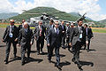
President Medvedev at L'Aquila airfield


Web links
- Airport data on World Aero Data ( 2006 )
- Official website (Italian)
- Aeroclub L'Aqula (Italian)