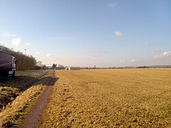
Sarreguemines Airfield
| Sarreguemines airfield | |
|---|---|

|
|
| Characteristics | |
| ICAO code | LFGU |
| Coordinates | |
| Height above MSL | 260 m (853 ft ) |
| Transport links | |
| Distance from the city center | 2 km northeast of Sarreguemines |
| Street | D 974 (formerly N 74 ) |
| Basic data | |
| opening | 1932 |
| operator | L'Aéroclub de Sarreguemines à une section, ANEG (Aéroclub National des Electriciens et Gaziers) |
| surface | 3.2 ha |
| Runways | |
| 05L-23R | 710 m × 150 m lawn (herbs) |
| 05L-23R | 710 m × 80 m lawn (herbs) |
The Sarreguemines airfield (German actually Flugplatz Saargemünd , French aérodrome de Sarreguemines , also aérodrome de Sarreguemines- Neunkirch or airfield Saargemünd-Neunkirchen ) is an airfield in the French community of Frauenberg near the city of Saargemünd in Lorraine . It is located directly on the German border with Saarland and is now used exclusively for sports purposes .
literature
- Nos ailes; l'espoir aéronautique de Sarreguemines de 1932 à 1950, ed. by Dépôt de la société des écrivains d'Alsace et de Lorraine, Vol. 19, Impr.sarregueminoise, Saargemünd 1992.