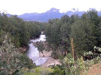
Forbes River (Hastings River)
| Forbes River | ||
|
Forbes River |
||
| Data | ||
| location | New South Wales , Australia | |
| River system | Hastings River | |
| Drain over | Hastings River → Tasman Sea | |
| source |
Werrikimbe National Park 31 ° 8 ′ 36 ″ S , 152 ° 21 ′ 25 ″ E |
|
| Source height | 965 m | |
| muzzle |
Hastings River at Yarra's coordinates: 31 ° 24 ′ 30 ″ S , 152 ° 20 ′ 34 ″ E 31 ° 24 ′ 30 ″ S , 152 ° 20 ′ 34 ″ E |
|
| Mouth height | 95.2 m | |
| Height difference | 869.8 m | |
| Bottom slope | 16 ‰ | |
| length | 52.8 km | |
| Small towns | Birdwood, Yarras | |
| Communities | Forbes River | |
The Forbes River is a river in the northeast of the Australian state of New South Wales .
It has its source in the eastern part of the Werrikimbe National Park . From there it flows south through largely unpopulated area. After leaving the national park, it flows through the small town of Birdwood and the Forbes River settlement . At Yarras on the Oxley Highway , it flows into the Hastings River .
