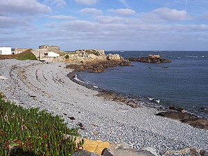
Fort Doyle (Guernsey)
| Fort Doyle | ||
|---|---|---|
|
Fort Doyle 2006 |
||
| Alternative name (s): | Doyle Battery | |
| Creation time : | 1803 | |
| Castle type : | Coastal fort | |
| Conservation status: | ruin | |
| Construction: | Ashlar | |
| Place: | Bordeaux | |
| Geographical location | 49 ° 30 '22.2 " N , 2 ° 30' 19.7" W | |
| Height: | 2 m ASLTemplate: height / unknown reference | |
|
|
||
Fort Doyle is the ruins of a coastal fort near the village of Bordeaux on the northeast tip of the Channel Island of Guernsey . Its construction was decided in 1803, in the middle of the coalition wars , by the States of Guernsey . The fort lies to the east of Fontenelle Bay .
The fort was named after General Sir John Doyle, 1st Baronet (1756-1834), Lieutenant Govenor of Guernsey, who did a lot for the island's defense.
The fort, which was initially called Doyle Battery and has a special, round shape, was equipped with three 18-pounder cannons. One was set up on a platform on the north side, the other two on propellers pointed east and west. In the fort there was a guardroom, an ammunition storage room and accommodation for the chief gunner.
In 1847 the States of Gunersey handed the fort over to the English Crown and in 1860 the Board of Works had it expanded and two more cannons installed on wooden platforms. After the Platte Fougère lighthouse was built in 1909, the fort served as a foghorn station and warehouse.
During World War II , Fort Doyle was fortified by the Germans who had occupied the Channel Islands. Its code name was Nebelhorn base and three coastal defense cannons, anti-aircraft cannons and mortars were equipped.

