Freedom (mountain)
| freedom | ||
|---|---|---|
|
The summit towers of freedom are exactly in the center of the picture. To the left the higher Hundstein . |
||
| height | 2140 m above sea level M. | |
| location | Canton of Appenzell Innerrhoden , Switzerland | |
| Mountains | Appenzell Alps | |
| Coordinates | 748 471 / 235355 | |
|
|
||
| rock | limestone | |
| First ascent | On September 21, 1884 through Bodenmann, Döring and Eugster via today's normal route | |
| Normal way | Up below the Hundstein on the marked hiking trail, then easy climbing ( 2a ) over the northeast side | |
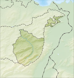
The freedom is a 2140 m above sea level. M. high mountain in the Alpstein massif in the Appenzell Alps . It is located in the Swiss canton of Appenzell Innerrhoden .
location
The freedom lies in the middle of the three ridges of the Alpstein, four kilometers east of the Säntis . The immediate eastern neighbor is the Hundstein , from which it is separated by the Höll, a deeply cut gorge. The freedom towers connect to the west and lead in a ridge over the Fälentürm to the southwest to the Altmann . To the north it falls in a rugged wall to Meglisalp . In the south it has a steep rock wall structured by several bands, which slopes down into rocky grass flanks into the valley above the Fälensee .
Climbing opportunities
The normal route was first climbed on September 21, 1884 by EW Bodenmann, Döring and K. Eugster, this also represents the first secured ascent. The route leads over a marked hiking trail in the direction of Hundstein. Shortly before the summit of the Hundstein, the tour leads over a small rock step and a grass slope into the gorge between Freiheit and Hundstein and from there with easy climbing ( 2a ) to the summit.
A classic wall climbing in the fourth degree of difficulty leads through the south face, which is climbed relatively often. The tour was first started on October 9, 1921 by Wilhelm Knoblich and Otto Ritz.
Today, the west ridge is counted among the most outstanding achievements in access alpinism. Georg Heinrich and Emil Oppe mastered difficulty 5+ in the Alps for the first time in 1907. Since they themselves rated the route as IV, this performance was ignored in alpine circles.
Crescent moon
In September 2016, the Appenzell artist Christian Meier installed a crescent moon illuminated with solar power as an alternative summit cross .
Literature and map
- Werner Küng: Alpstein climbing guide . SAC Verlag 2001, 2nd edition, p. 147 ff.
- National map of Switzerland: Säntis . No. 1115.
Individual evidence
- ↑ Three meter high crescent moon on Alpstein summit causes outrage , Tagblatt Online, September 6, 2016.

