Friedrich-Schiller-Höhe
|
Friedrich-Schiller-Höhe
City of Strausberg
Coordinates: 52 ° 35 ′ 37 ″ N , 13 ° 53 ′ 6 ″ E
|
|
|---|---|
| Height : | 80 m |
| Residents : | 168 (2006) |
| Postal code : | 15344 |
| Area code : | 03341 |
|
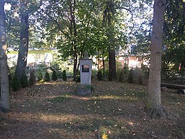
Schiller statue at the Schillerhöhe
|
|
Friedrich-Schiller-Höhe is a residential area in the town of Strausberg in the Märkisch-Oderland district in Brandenburg .
location
The place is one kilometer north of the city center of Strausberg, on the other side of the Straussee . The neighboring towns are Wilkendorf and Gartenstadt in the northeast, Roter Hof in the east, Stausberg in the south, Beyond the lake in the southwest and Gielsdorf in the northwest. The place can be reached via the Strausberg bypass (L 23). The Kleine Babe stream flows west of the village and flows into the Straussee a little later.
Web links
- Friedrich-Schiller-Höhe in the genealogical index of places
Individual evidence
- ↑ State surveying and geo-base information Brandenburg (Ed.): Local and community directory Brandenburg . 2007.
- ^ City of Strausberg - districts according to § 45 municipal constitution - living spaces. Ministry of the Interior and Local Affairs of the State of Brandenburg, accessed on September 11, 2016 .
- ↑ BrandenburgViewer of the state survey and geographic base information Brandenburg (LGB)
