
Frondell Alm
| Frondell Alm | ||
|---|---|---|
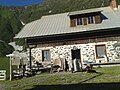
 The hut of the Frondell Alm |
||
| location | North of the bait height / bait head; Carinthia ; Valley location: Weidenburg (district of Kötschach-Mauthen ) | |
| Mountain range | Carnic Alps | |
| Geographical location: | 46 ° 37 '17.5 " N , 13 ° 1' 24" E | |
| Altitude | 1523 m above sea level A. | |
|
||
| owner | Agricultural community Grossfrondell | |
| Built | Rebuild in 2000 | |
| Construction type | Alpine hut ; Stone, lime, wood | |
| Development | Almstrasse | |
| Usual opening times | Mid June to late September | |
| accommodation | 0 beds, 0 camps , 2 emergency camps | |
| Web link | http://www.frondell-alm.at/ | |

The Frondell Alm (also Großfrondell Alm or Obere Frondell Alm) is an Alm located at 1523 m above sea level in the Austrian part of the Carnic Alps ( Carinthia ). During the First World War , the alpine pasture area was one of the most contested areas and known for the longest inclined elevator that was built during the war. Today the Alm is known as the westernmost Gailtaler Almkäse Alm and is open from June to September. The alpine pasture area borders the Carnic High Trail in the south .
history
After Italy declared war on Austria-Hungary on May 23, 1915 , work began on topping up the thin rifle veil on the entire Carinthian border (115 km). The particularly important border crossing Plöckenpass was therefore defended in the first days of the war by simulating a line between the Wolayersee - Valentintal - Angerbachtal and the Köderhöhe . It was not until the end of May 1915 that the southern Hungarian VII Corps, Commander General d. Archduke Joseph's cavalry and reinforced by the Austro-Hungarian 59th Mountain Brigade. On May 29, 1915, the first Italian advance came, which led to a battle over the border ridge in May and June and to the loss of a good 1,000 men on both sides. Later a trench warfare with attacks and defenses was waged in this border section.
The soldiers stationed on Köderhöhe were supplied from the Frondell Alm. For the time being, this was done via the so-called Kreuzsteig. This was created in 13 days with 103 serpentines over an altitude difference of 600 m. In this way, the supply of the team, which was housed in caverns , extensive barracks and positions on the Köderhöhe , could be guaranteed by means of pack animals and porter columns. In 1915 the longest Bremsberg ( inclined elevator 1040 m length) of the Austro-Hungarian Army was built from the Frondell Alm to the Köderhöhe . This had an hourly output of 1500 kg. However, as early as the first winter, avalanches caused the elevator to be interrupted again and again and then every loaf of bread and every grenade had to be brought back to the heights by columns of carriers. After the experience of the avalanche damage in the winter of 1915/16, an additional cable car (cable car 57) was built from the Köderhöhe to the Kronhofgraben.
In winter, more soldiers died in the abovementioned border area from avalanches than from enemy action. After the war, the completely destroyed alpine hut of the Frondell Alm was rebuilt by the Villach agricultural district authority at the time .
Cheese making

Before the 1960s and 1970s, the Frondell Alm was one of the most famous cheese farms in the Gail Valley . Gradually, however, the production of cheese became less important and the dairy at the Frondell Alm was also stopped.
Only after a rethinking process with a change in the direction of an extensive, ecologically oriented and quality-conscious form of business and corresponding public funding offers had begun in agriculture, the decision was made to join the association "Community of Gailtaler Almsennerei" and after a complete renovation of the alpine hut in 2000 to start again with the production of Gailtaler Almkäse PDO .
Today, like on 13 other alpine pastures in the Gailtal, Gailtaler alpine cheese, goat cheese , alpine butter and Schotten are again produced on the Frondell Alm . Therefore it is a popular destination for day tourists and hikers in the summer months (mid-June to the end of September).
Cruciform
The Kreuzsteig is a path that was built between the Frondell Alm and the Köderhöhe during the First World War and was used for replenishment. The path was built in 13 days in 1915 and has 103 serpentines with which a difference in altitude of a good 600 m is overcome. For many years the route was looked after by the Austrian Alpine Club Section Obergailtal-Lesachtal. After the path is closed, it is now looked after by a group of private people (mowed, marked, repaired).
For the 2.8 km long way to Köderhöhe you need about 1½ hours to climb and there you have a direct connection to the Carnic High Trail 403 .
Ascents
- from Würmlach (697 m) over the Würmlacher Alpl and the Würmlacher Höhe, in 4½ hours
- from Weidenburg (670 m) through the Kronhofgraben, in 3½ hours
- from the Plöckenpass ( 1357 m ) via the Karnischer Höhenweg 403 and the Kreuzsteig, in 5 hours
Summit tours
- Köderhöhe ( 2228 m ) via Kreuzsteig, in 1½ hours
- Köderkopf ( 2167 m ) via Kreuzsteig, in 1½ hours
- Laucheck ( 2156 m ) via the Kessel of the Frondell Alm, in 1½ hours
- Blaustein ( 2195 m ) via Kreuzsteig, Karnischen Höhenweg to Kronhofer Törl, in 3½ hours
- Würmlacher Höhe ( 1960 m ), over the Kessel of the Frondell Alm, in 1 hour
Neighboring huts, alpine pastures and inns
- Gasthof Plöckenhaus ( 1244 m ), in 5 hours
- Zollnerseehütte ( 1750 m ), in 4 hours
- Rifugio Casera Pramosio ( 1520 m ), in 3½ hours
- Würmlacher Alm ( 1637 m ) in 2 hours
- Brugger Alm ( 1574 m ), in 1½ hours, unmanaged
- Lower Bischofalm ( 1181 m ), in 1½ hours
photos

Frondell Alm from the Brugger Alm

South-east view of the Frondell Alm

Frondell Alm with Köderhöhe and Köderkopf in the background
In the courtyard of the Frondell Alm


literature
- Gailtal- Lesachtal- Karnischer Höhenweg. (= Kompass hiking guide. Volume 982). Kompass Karten GmbH, 2008, ISBN 978-3-85491-499-0 .
- Gabriele and Walther Schaumann : On the way from the Plöckenpass to the Canal Valley. On the trail of the Carnic Front 1915–1917. Verlag Mohorjeva - Hermagoras, Klagenfurt 2004, ISBN 3-7086-0025-8 . (with tour guide)