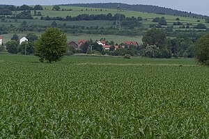
Fulda mountain
| Fulda mountain | ||
|---|---|---|
|
Partial view from the east (Berka / Werra) |
||
| height | 332 m above sea level HN | |
| location | Thuringia ( Germany ) | |
| Mountains | Richelsdorf Mountains | |
| Coordinates | 50 ° 58 '6 " N , 10 ° 2' 32" E | |
|
|
||
| rock | Red sandstone | |
| particularities | Panoramic view, historical border point | |
The Fulda mountain is a 332 m high mountain and is mainly located in the district of Gerstungen in the Wartburg district in Thuringia .
The Fulda mountain has been part of the Hessian-Thuringian border for centuries and offers a panoramic view of the Gerstung valley basin of the Werra valley . The name is reminiscent of an important border point in the border descriptions of the monasteries Fulda and Hersfeld . The mountain was cleared and used for agriculture in the Middle Ages, even today the arable land and meadows on the Thuringian side extend up to the summit. In the GDR era, the mountain had a certain strategic importance as an observation point. Today there is a refuge for hikers on its summit. The steep slope on the Hessian side of the mountain could only be used for grazing and was afforested after the Second World War. This forest north of the Roterainsmühle belongs to Richelsdorf .
Individual evidence
- ↑ Official topographic maps of Thuringia 1: 10,000. Wartburgkreis, district of Gotha, district-free city of Eisenach . In: Thuringian Land Survey Office (Hrsg.): CD-ROM series Top10 . CD 2. Erfurt 1999.

