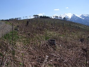
Górków Wierch
| Górków Wierch | ||
|---|---|---|
|
Summit with Tatras in the background |
||
| height | 1046 m npm | |
| location | Poland , Slovakia | |
| Mountains | Pogórze Spiskie , Pogórze Spisko-Gubałowskie , Carpathian Mountains | |
| Coordinates | 49 ° 18 '32 " N , 20 ° 10' 3" E | |
|
|
||
| Type | Rock peaks | |
| rock | limestone | |
The Górków Wierch is a mountain in the Polish Pogórze Spiskie , a mountain range of the Pogórze Spisko-Gubałowskie , with an altitude of 1046 meters above sea level. The Polish-Slovakian border runs at the summit.
Location and surroundings
The Kuraszowski Wierch is located in the main ridge of the Pogórze Spiskie. The Łapszanka mountain stream lies south of the summit .
tourism
The summit can be easily reached from all surrounding villages on marked hiking trails. It is outside the Tatra National Park .
Winter sports
The Jurgów ski area is located on the northern slope of the mountain .
Web links
Commons : Górków Wierch - collection of images, videos and audio files
literature
- Witold Henryk Paryski, Zofia Radwańska-Paryska: Wielka encyklopedia tatrzańska. Wydawnictwo Górskie, Poronin 2004, ISBN 83-7104-009-1 .
- Józef Nyka: Pieniny. Przewodnik. 9th edition. Trawers, Latchorzew 2006, ISBN 83-915859-4-8 .
- Pieniny polskie i słowackie. Mapa turystyczna 1:25 000. Agencja Wydawnicza "WiT" sc, Piwniczna 2008, ISBN 978-83-907671-3-0 .

