Gafallengrat
| Gafallengrat | ||
|---|---|---|
|
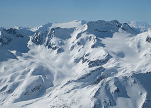
Eastern branch of the Gafallengrat in the foreground on the right |
||
| height | 2719 m above sea level M. | |
| location | Canton of Uri | |
| Mountains | Lepontine Alps | |
| Dominance | 1.1 km → Gurschenstock | |
| Notch height | 150 m ↓ 2564 | |
| Coordinates | 691 257 / 161972 | |
|
|
||
The Gafallengrat is a 2719 meter high mountain in the Swiss canton of Uri .
Location and surroundings
It lies in the middle of a ridge that begins at the Gemsstock (2961 m) to the west and falls east to south into the valley of the Unteralpreuss . The next significant place is Andermatt , which is about five kilometers to the northwest as the crow flies .
Literature and maps
- National map of Switzerland 1: 25,000, sheet 1232, Oberalp Pass

