Ganserlberg
| Ganserlberg | ||
|---|---|---|
|
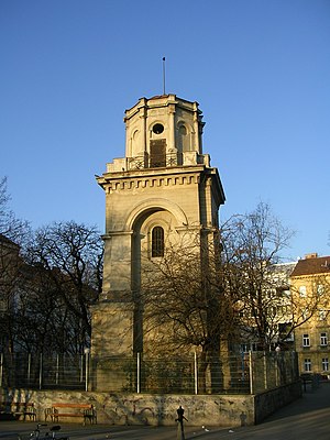
Währinger water tower on Ganserlberg |
||
| height | 211 m above sea level A. | |
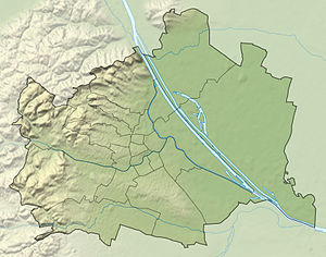
| location | Vienna , Austria | |
| Mountains | Vienna Woods | |
| Coordinates | 48 ° 13 '20 " N , 16 ° 20' 24" E | |
|
|
||
The Ganserlberg (also Ganslberg or Anna Berg) is a hill in the 18th Viennese district of Währing . It forms the continuation of the ridge from the Schafberg (390 m) over the Mitterberg to the Gürtel and is part of the Vienna Woods Mountains. Together the ridge formed the right, southern bank of the Währinger Bach . Today the hill occupies the area between Anton-Baumann-Park ( 203 m ) and Johann-Nepomuk-Vogl-Platz ( 211 m ).
The name of the Ganserlberg was mentioned in a city map by Anton Ziegler in 1850. The name is said to come from an inn that was located near today's Luther Church and was famous for its roast goose. Other well-known buildings on Ganserlberg are the Lazarist Church by the architect Friedrich von Schmidt and the Währinger water tower in Anton-Baumann-Park. Until 1864, today's Schumanngasse was called Ganserlberggasse, and between 1864 and 1894 it was called Annagasse.
literature
- Walter Herrmann: The field names of the 18th district of Vienna. Part II. Vienna 1958.
- Christine Klusacek, Kurt Stimmer: Währing. From the Ganserlberg to the Schafberg. Mohl, Vienna 1992.

