Garden valley
| Garden valley | ||
|---|---|---|
|
Coordinates: 32 ° 42 ′ S , 57 ° 59 ′ W Garden valley on the map of Uruguay
|
||
| Basic data | ||
| Country |
|
|
| Department | Río Negro | |
| City foundation | 1951 | |
| City insignia | ||
| Detailed data | ||
| Church in Gartental | ||
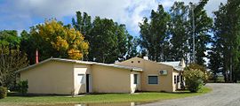
| Central building with almacén | ||
| Landscape near Gartental | ||
Gartental is a place in the Río Negro department in Uruguay and is located near San Javier , to which it is also politically assigned. Gartental was founded in 1951 by Mennonites from West Prussia , Danzig and Russia - by subdividing the former "Brabancia" estate, 435 people could initially be accommodated. On the deep, alluvial land of the Río Uruguay and the Río Negro, wheat, barley, oats, sugar beet and maize are grown in addition to dairy farming.
See also
Web links
Commons : Gartental - Collection of images, videos and audio files
- Gartental information at The Global Anabaptist Mennonite Encyclopedia Online (GAMEO)
- Gartental Children's Sports Festival Information from the German Embassy in Montevideo
Individual evidence
- ↑ [1]
- ↑ Gartental (GAMEO, in English)
- ↑ The way of the Mennonites from the Netherlands to Uruguay on www.mennonitasuruguay.org ( page no longer available , search in web archives ) Info: The link was automatically marked as defective. Please check the link according to the instructions and then remove this notice.


