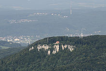
Gempen Plateau
The Gempenplateau is a highland in northwestern Switzerland , southeast of Basel .
The Table Jura plateau is 600 to 700 meters above sea level and belongs entirely to the area of the canton of Solothurn , which is here the furthest to the north. Over long stretches, steep forest flanks and rows of rivers (cliffs) form the border against the deeper areas that belong to the canton of Basel-Landschaft .
Strategic importance
From the Gempenplateau you have a comprehensive view of the surrounding valleys. Therefore, in earlier times, when the canton of Solothurn was still an independent state, so-called Hochwachten were set up on the Schartenfluh, the Schauenburgerfluh (east of the plateau, above Liestal ) and on the hill south-east of Gempen . In uncertain times, teams from Solothurn kept a lookout here and had to pass on important messages from high watch to high watch and to alert the population at night through blazing fires that were smoking during the day.
During the Second World War , the Gempen area was massively reinforced militarily with the artillery positions Gempenplateau . The background was Maneuver H , a Franco-Swiss military cooperation planned for the event of a German attack on Switzerland. The Gempen plateau was suitable as a defensive position against a bypassing of the French Maginot line by German troops . Numerous bunkers and other fortifications have been preserved to this day. Some of the prepared positions are obviously also suitable for use by French artillery .
Observation tower
The highest point on the Gempenplateau is the 753 meter high Scharten . At its highest point is the Gempenturm , built in 1897, with a view of the entire Basel region. On a clear day you can see the Vosges, the Black Forest and sometimes the Swiss Alps from there. Due to its Fluh - the Schartenfluh - located immediately southeast of the tower, the Scharten can be seen from afar. It is also known colloquially as the “Gempenstollen” or simply “the Gempen”.
Arid highlands
The highlands are wavy and in the middle they are crossed by the Mulde from Gempen to Hochwald . There is no stream on the entire plateau, and the highlands are heavily forested around the villages and dry fields, meadows and pastures. Because of the harsh climate, it rains a little more here than in the areas around Basel , but the geology of Table Mountain is responsible for the water scarcity. The subsoil of the plateau consists of limestone and clay . The layers are not folded, but lie horizontally. Since the limestone is dissolved by water, the subsoil is criss-crossed with numerous crevices ( karst ) and permeable to water, so that the rainwater seeps away ( seepage ). The lack of water on the mountain is a big problem and it has to be taken in wells or below the plateau and pumped up.
natural reserve
The Gempenplateau with the municipalities of Büren , Dornach , Gempen , Hochwald , Nuglar-St. Pantaleon and Seewen is in the Federal Inventory of Landscapes and Natural Monuments of National Importance (BLN).
Coordinates: 47 ° 27 '59 " N , 7 ° 39' 51" E ; CH1903: 617000 / 257300
Web links
Individual evidence
- ↑ Hans Senn : The operational importance of the plateau of Gempen in the Second World War. In: Federal Department of Defense, Civil Protection and Sport (ed.): Military monuments in the cantons of Solothurn, Basel-Stadt and Basel-Landschaft. Inventory of the combat and command structures. (pdf, 7.5 MB) pp. 12-15.
- ↑ Lock point Gempenplateau. ( Memento of the original from March 15, 2016 in the Internet Archive ) Info: The archive link was inserted automatically and has not yet been checked. Please check the original and archive link according to the instructions and then remove this notice. In: Federal Department of Defense, Civil Protection and Sport (ed.): Military monuments in the cantons of Solothurn, Basel-Stadt and Basel-Landschaft. Inventory of the combat and command structures. (pdf, 7.5 MB) pp. 30-31.

