
Hochwald SO
| SO is the abbreviation for the canton of Solothurn in Switzerland and is used to avoid confusion with other entries in the name Hochwald . |
| High forest | |
|---|---|
 |
|
| State : |
|
| Canton : |
|
| District : | Dorneck |
| BFS no. : | 2475 |
| Postal code : | 4146 |
| Coordinates : | 615 207 / 256260 |
| Height : | 620 m above sea level M. |
| Height range : | 465–730 m above sea level M. |
| Area : | 8.35 km² |
| Residents: | 1310 (December 31, 2018) |
| Population density : | 157 inhabitants per km² |
| Website: | www.hochwald.ch |
 Primary school |
|
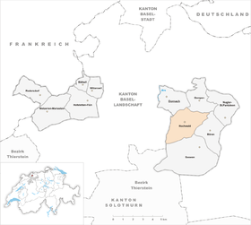
| Location of the municipality | |
  |
|
Hochwald , colloquially pronounced “Hobel” in the region , is a political municipality in the Amtei Dorneck-Thierstein or in the Dorneck district of the canton of Solothurn in Switzerland .
geography
Hochwald lies at 620 m above sea level. M. , 12 km south-southeast of the city of Basel (linear distance). The village extends in a hollow on the plateau of the Gempen plateau in the Table Jura , in the Black Boy Country .
The area of the 8.3 km² municipal area covers a section of the northern Jura . The area is occupied by the high plateau of the Dorneckberg. Along a tectonic fault line extending from south-southwest to north-northeast, the approximately 500 m wide hollow of Hochwald was formed, which divides the table of the Gempen plateau into a higher eastern and a lower western part. No surface rivers can be found in the entire municipality. The rainwater immediately seeps into the karst subsoil and only emerges again at the layer boundaries of the slopes of the Dorneckberg. A well-developed dry valley leads from the Mulde to the west in the direction of Duggingen , but it is not reactivated even if there is persistent heavy rainfall.
The Uf der Hollen ridge ( 699 m above sea level ) connects to the west of the Hochwald hollow , and the Eichenberg ( 700 m above sea level ) to the north . The Tüfleten valley basin also still belongs to Hochwald. To the south-west the area extends to the Falkenflue ( 624 m above sea level ), which drops steeply towards the Birstal . In the east, the municipality extends over the mostly wooded ridges of Chälen , Langmatt (at 729 m above sea level, the highest elevation in Hochwald) and Nattenberg ( 704 m above sea level ). Both in the west and in the east the border runs mostly on the edge of the step before the steep drop to the lower areas. Towards the south, the hollow is separated from the Seetal by the ridge at Ziegelschüren. In 2014, 10% of the municipal area was accounted for by settlements, 45% for forests and woodlands and 45% for agriculture.
Hochwald includes the former hamlet of Chilchenrain ( 650 m above sea level ) adjoining the village to the east, the Nattenberg residential area ( 704 m above sea level ) on the ridge east of the village, the Herrenmatt farm estate ( 615 m above sea level ). on the western edge of the plateau and some individual courtyards. The neighboring communities of Hochwald are Dornach , Gempen , Büren and Seewen in the canton of Solothurn and Duggingen in the canton of Basel-Landschaft .
population
With 1,310 inhabitants (as of December 31, 2018), Hochwald is one of the medium-sized communities in the canton of Solothurn. 97.6% of the residents speak German, 0.5% speak Italian and 0.5% speak French (as of 2000). The population of Hochwald was 624 inhabitants in 1850 and 582 inhabitants in 1900. In the course of the 20th century, the population decreased further to 448 people by 1941 due to strong emigration. After a phase of stagnation, a significant increase in population has been recorded since 1970 (507 inhabitants) combined with a doubling of the number of inhabitants within 25 years.
economy
Up until the second half of the 20th century, Hochwald was a predominantly agricultural village. In the 19th century, a silk winding mill, a turnery and two brick factories started operations. Even today, arable farming , fruit growing (mainly cherry trees) as well as cattle and dairy farming have an important place in the income structure of the population. Hochwald is also known for the production of butten must . Further jobs are available in local small businesses and in the service sector, including in companies in the construction industry, IT and in a gardening center. In the last few decades the village has developed into a residential community. Many employees are therefore commuters who work mainly in the Basel region.
From the late 1970s to the early 1980s, the German sculptor and metal sculptor Raimund Böll , a son of the Nobel Prize winner Heinrich Böll , ran a sculpture school in Hochwald. It was completed by the visual artist Alex Zwalen, among others; and the sculptor Tobias Mattern trained there from 1979 to 1981 in stone carving. Raimund Böll died in 1982 at the age of 35. At the beginning of 1998, the Trotte local museum in nearby Arlesheim showed an exhibition of his works, which could then also be seen in the Kunst Forum in Bonn .
traffic
The community is located off the main thoroughfares on the connecting road from Gempen to Seewen . The next connection to the high-speed road H18 (Basel-Delémont) is about 6 km from the town center. The village is well connected to the public transport network thanks to a well-developed PostBus course , which covers the route from Dornach to Hochwald and Mondays to Saturdays to Seewen, Büren and Liestal .
history
The place was first mentioned in a document in 1225 under the name Honwalt , which over time changed to Hochwald. The altitude of the settlement was decisive for the naming. In the Middle Ages , Hochwald belonged to the property of the diocese of Basel , which maintained a Dinghof here ; it was part of the Birseck rule. The Schöntal Monastery also owned various goods in the municipality. During the Swabian War , Hochwald was badly affected by imperial troops.

In 1509, Hochwald came to Solothurn by pledge and was assigned to the Thierstein bailiwick and the Dorneck district court. The villagers adopted the new faith during the Reformation . After Solothurn had also acquired the church set in 1530, however, it reintroduced Catholic worship. After the collapse of the Ancien Régime (1798), Hochwald belonged to the Dornach district during the Helvetic Republic and from 1803 to the Dorneck district.
On April 10, 1973 crashed after a failed landing on the Basel-Mulhouse airport a Vickers Vanguard of Invicta International Airways in the hamlet Herrenmatt into the forest (→ International Airways flight Invicta 435 ). In memory of this crash , a memorial was erected near the crash site.
Attractions
The St. Gallus church, which originally dates back to a medieval church, was given its current appearance as part of the new building in 1821. In the old town center, some characteristic farmhouses from the 17th to 19th centuries have been preserved.
In the area around Hochwald there are numerous Jura rock faces with many climbing routes and bouldering problems of varying degrees of difficulty.

coat of arms
- Split by red with a white Basel staff turned to the left and by white with three green fir trees standing on a green plan
The coat of arms alludes to the former affiliation to the Principality of Basel.
literature
- Gottlieb Loertscher: The art monuments of the canton of Solothurn, Volume III: The districts of Thal, Thierstein, Dorneck. (= Art Monuments of Switzerland. Volume 38). Edited by the Society for Swiss Art History GSK. Bern 1957, DNB 750089342 .
Web links
- Official website of the municipality of Hochwald
- Lukas Schenker: Hochwald SO. In: Historical Lexicon of Switzerland .
Individual evidence
- ↑ Permanent and non-permanent resident population by year, canton, district, municipality, population type and gender (permanent resident population). In: bfs. admin.ch . Federal Statistical Office (FSO), August 31, 2019, accessed on December 22, 2019 .
- ↑ Alex Zwalen - Curriculum ( Memento from August 22, 2010 in the Internet Archive ), on the Alex Zwalen website (accessed on February 16, 2009).
- ^ Exhibition directory >> Raimund Böll (accessed on February 16, 2009).
- ^ Exhibition catalog 1998 >> Solo exhibitions in Arlesheim and Bonn in 1998 (accessed on April 21, 2013).