
Gerbergraben (Stiglbach)
| Gerbergraben | ||
 The Gerbergraben, here in the reed shortly before the confluence with the Stiglbach at high water |
||
| Data | ||
| Water code | AT : 8114010101 | |
| location | Vorarlberg , Austria | |
| River system | Rhine | |
| Drain over | Fußenauerkanal → Dornbirner Ach → Rhine → North Sea | |
| Source height | 475 m | |
| muzzle | in the Stiglbach coordinates: 47 ° 26 '32 " N , 9 ° 43' 26" E 47 ° 26 '32 " N , 9 ° 43' 26" E |
|
| Mouth height | 404 m | |
| Height difference | 71 m | |
| Bottom slope | 19 ‰ | |
| length | 3.7 km | |
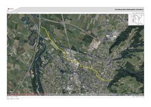
The Gerbergraben is a flowing body of water that flows on the Fallenberg , under the "Stiglerhalda" parcel at about 475 m above sea level. A. rises and drains through the northern municipality of Dornbirn, Haselstauden district , to the Stiglbach .
Source, course of estuary, geology, geography
The Gerbergraben begins at water kilometers (GwKm) 3.72 on Fallenberg and flows relatively straight from south-east to north-west. Around two thirds of the total length flow through densely populated residential and commercial areas and are largely piped or tightly built. The Gerbergraben does not show any significant gradients, washouts or waterfalls and, in terms of the amount of water, is heavily dependent on the previous rainfall and is heavily thinned out during longer dry periods.
Tributaries
The Gerbergraben has only a few insignificant tributaries. These are (seen from the origin) in the upper area up to the mouth at river kilometers:
- 3,551 an unnamed source tributary, R,
- 3,549 an unnamed source tributary, L,
- 2.66 a short junction of the main arm, also known as the Gerbergraben, L,
- 2.30 Stockachgraben, R,
- 2.00 Simonsgraben, L,
The Gerber ditch flows at river kilometer 0.00 (at about 404 m above sea level. A. ) in the hallway Martesrua ( "Marte peace"), just ahead of the Rhine Valley motorway (A14 / E60) in the Stiglbach (also called Haselstauderstraße Bach, at river kilometer 0,251 ). In the lower area (last third), from the district of Wieden, the Gerbergraben was also known as "Wiedengraben".
The Gerbergraben flows entirely through the municipality of Dornbirn .
Flood protection
In April 2017, work began to improve flood protection at Gerbergraben by creating a retention basin in the “Fang” district. Around one million euros were invested. The retention basin has a capacity of around 4000 m³ and is only filled during heavy rain. This is said to have improved the protection of the sulfur settlement area below to such an extent that the controlled retention and runoff can withstand a hundred-year flood event.
Economic use
The Gerbergraben was previously used economically, which is already indicated by the name "Gerbergraben". The tannery of the Gerberei Genossenschaft operated in the area of GwKm 3.32 , now a residential building (Dr. Anton-Schneider-Straße 50), was originally on the edge of the settlement area, but was being renovated more and more. The tannery ceased operations around the end of the 1960s. Until then, the tannery had been draining the sewage from the tannery. The tannery is built directly over the tannery. Two streets directly adjacent to the former tannery, the “Gerbergasse” and “Am Gerbergraben”, are still reminiscent of this smell- and water-intensive activity. The former, somewhat elevated and enclosed storage area for the raw animal hides and the waste can still be seen today (now a parking lot - southwest side of the former tannery).
Web links
Individual evidence
- ↑ Retention system at Gerbergraben , Dornbirner Gemeindeblatt of April 14, 2017, p. 9.
- ↑ Flood protection Gerbergraben , Dornbirner Gemeindeblatt from October 19, 2018, p. 3.
- ↑ Dornbirn Lexicon , search term: "Am Gerbergraben I./IV.".