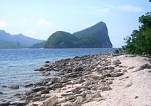
Gulf of Ragay
| Gulf of Ragay | ||
|---|---|---|
|
Location of the Gulf of Ragay in the Bicol region |
||
| Waters | Sibuyan lake | |
| Land mass | Luzon | |
| Geographical location | 13 ° 44 ' N , 122 ° 36' E | |
|
|
||
| width | 50 km | |
| depth | 90 km | |
| Medium water depth | 200 m | |
The Gulf of Ragay is a largely land-enclosed bay in the southeast of the island of Luzon , in the Philippines . It is a sea bulge in the northeast of the Sibuyan Sea and extends from the coast of the Bondoc Peninsula to the Bicol Peninsula . In the northern part of the gulf the water has a lower salinity due to the inflows of fresh water, the sources of which are at Mount Labo .
The coastline of the Gulf of Ragay is determined by a mixture of mangrove forests , sandy beaches and extensive marshland , which dry out at low tide . The mean tidal range is 1.25 meters. In front of the coastline are numerous coral reefs . In the places along the coast, some artificial aquacultures have been established over the past few decades , which breed a wide range of marine fauna.

The climate in the area of the Gulf of Ragay is tropical, humid and warm without a pronounced dry season. Rainfalls occur all year round. The Gulf of Ragay is popular with tourists for diving; Whale sharks , bottlenose dolphins and East Pacific dolphins , among others , can be seen. In the Gulf is the Alibijaban Wilderness Area , on the island of the same name.

