
Gorieswerder

.jpg)
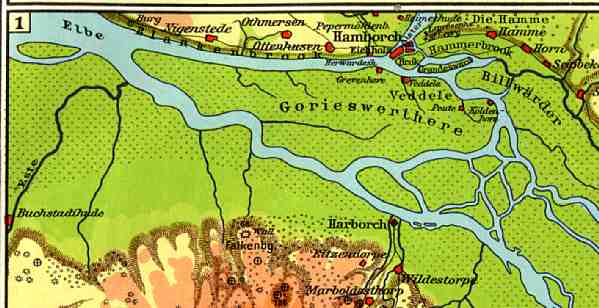
The Gorieswerder was a river island on the Elbe in Hamburg , which disintegrated into several islands due to storm surges.
Before it broke up, Gorieswerder was inhabited, diked and stretched from Finkenwerder to Kaltehofe . In December 1248, the Allerkind flood separated the former islands of Finkenwerder and Altenwerder from Gorieswerder. In the 14th and 15th centuries, other islands were separated and the Köhlbrand developed.
On a map of the Elbe from 1628 and a map from 1878, one of the island fragments is recorded as Greiswerder and Griesenwerder ; it gave the former Griesenwerder harbor its name.
Web links
Individual evidence
Coordinates: 53 ° 32 ' N , 9 ° 55' E