Governor Islands
| Governor Islands | ||
|---|---|---|
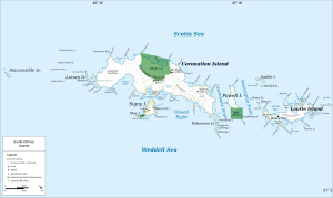
| Map of the South Orkney Islands with the Governor Islands immediately off the northeast coast of Coronation Island | ||
| Waters | Scotia Lake | |
| archipelago | South Orkney Islands | |
| Geographical location | 60 ° 31 ′ S , 45 ° 56 ′ W | |
|
|
||
| Residents | uninhabited | |
The Governor Islands (translated from English Governor Islands ) are a scattered group of islands and cliff rocks in the archipelago of the South Orkney Islands . They are 800 m north of Penguin Point , the northwestern extension of Coronation Island .
It was discovered during the joint voyage of the British seal hunter captain George Powell and his American counterpart Nathaniel Palmer to the South Orkney Islands in December 1821. The Norwegian whaler captain Petter Sørlle roughly mapped it during his visit to the South Orkney Islands from 1912 to 1913. He named it Allardyce Øyane (Norwegian for Allardyce Islands ) after William Lamond Allardyce (1861–1930), Governor of the Falkland Islands from 1904 to 1914. On Argentine maps from 1933 and 1947 they are named as Islas Governor and Islas Gobernador, respectively. The now established English-language name goes back to a decision of the Advisory Committee on Antarctic Names in 1952.
Web links
- Governor Islands in the Geographic Names Information System of the United States Geological Survey (English)
- Governor Islands on geographic.org (English)

