Grímsey
| Grímsey | |
|---|---|
| Waters | Greenland Sea |
| Geographical location | 66 ° 32 '37 " N , 18 ° 0' 5" W |
| length | 4.8 km |
| width | 1.9 km |
| surface | 5.3 km² |
| Highest elevation | Storholl 105 m |
| Residents | 103 (2007) 19 inhabitants / km² |
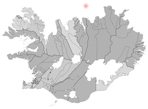
Grímsey is a small island 40 kilometers north of the north coast of Iceland . It belongs to the Icelandic region of Norðurland eystra . The island is located directly on the Arctic Circle and is the northernmost inhabited area of Iceland.
geography
Grímsey is located on the Arctic Circle that runs through the island. This makes the island the only inhabited place in Iceland where the midnight sun can be seen. The highest point is 105 m above sea level . The closest island is Flatey , 24 miles further south. The closest place on the main Icelandic island is Þönglabakki in the administrative district of Suður-Þingeyjarsýsla . The area of the island is 5.3 km 2 .
history
Glacier scrapes on the rocks on Grímsey are evidence that the island - like the rest of Iceland - was covered by glaciers in the Pleistocene . According to legend, the island is named after Grím, the first settler to be mentioned in Landnámabók . The island is mentioned in the Heimskringla , written around 1230 , because the Norwegian King Olav wanted to receive it as a gift from the inhabitants of Iceland. It is said from later times that Grímsey was spared the famine that hit Iceland again and again. The people of Grímsey were not only fed with fish, but also with the seabirds that live here in large numbers and their eggs. In 1915 a lighthouse was built on Grimsey, which was destroyed in a German air raid in World War II and rebuilt in 1949. In 1988 all sheep on Grímsey fell victim to an epidemic, so that there are no more sheep on the island today. Until May 31, 2009, the island formed an independent rural community (isl. Grímseyjarhreppur ). Since then it has belonged to the city of Akureyri .
traffic
The island has the small airport Grímsey ( IATA code GRY, ICAO code BIGR), which is approached from Akureyri . The only town on the island is not far south of the runway. The island's road network includes 3 km of paved roads. The interior of the island is criss-crossed by various hiking trails. From Dalvík there is a ferry from Akureyri to Grímsey three times a week . The journey time is about three hours, much longer in a storm. It is driven in almost any weather.
Bird watching
Cats and dogs are not allowed on the island, so birds are very good for watching, including puffins , razorbills , black guillemots , guillemots and several species of gulls . The protected crab grebe can also be seen on Grímsey, otherwise it is not found in Iceland.
Vegetation and climate
The vegetation - there are around 100 species of plants on Grímsey - is relatively barren and tundra-like . In the interior of the island, moors and grassy areas expand. Trees do not grow on Grímsey, only individual low bushes.
According to its location, Grímsey has a maritime-polar climate. The mean temperature of the coldest months (January, February) is around −1 ° C. In July an average temperature of +8 ° C is reached. The absolute temperature extremes are −20 ° C and +21 ° C. Frost can occur in any month. The total annual precipitation is about 559 mm.
Economy and tourism
The main livelihood of the islanders is fishing . Sheep breeding as well as catching seabirds and collecting their eggs were also important in the past. There are two guest houses on Grímsey for accommodating tourists. One of the main attractions of the island is a monument that shows the course of the Arctic Circle, which cuts through the northern part of the island. At the airport, a direction indicator shows the distances to Reykjavík (325 km), London, Moscow, New York, Tokyo and Sydney.
Population development
| Date * | Residents |
|---|---|
| 1997 | 99 |
| 2003 | 93 |
| 2004 | 92 |
| 2005 | 102 |
| 2006 | 99 |
| 2007 | 103 |
* on December 1st
Facilities
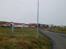
The only village on Grímsey has a school, a shop for daily needs, a post office, a community center, an indoor swimming pool and a library in the northern district of Sandvík. The church in the southern district of Miðgarður, where services are held four times a year under the direction of a pastor from the mainland, was built from driftwood in 1867 and renovated in 1956.
Trivia
The island of Grímsey is the setting for Fred Vargas ' novel The Compassionate Guillotine and Ulrich Schacht's novel Grimsey .
See also
- Kolbeinsey , the northernmost island of Iceland
- List of Icelandic islands
- List of extreme points in Iceland
- List of cities in Iceland
literature
- Bernhard Hantzsch : Contribution to the knowledge of the bird world of Iceland . Friedländer, Berlin 1905. (Online: Biodiversity Heritage Library, accessed May 8, 2009)
Individual evidence
- ^ Ewald Glässer: Island , p. 143. Darmstadt 1986.
- ↑ http://wayback.vefsafn.is/wayback/20070502132629/www.grimsey.is/um-grimsey/hversvegna/
- ↑ Barbara C. Titz: Island , p. 376. Bielefeld 2005.
- ↑ https://www.nat.is/island-grimsey-on-the-steingrimsfjordur-bay/
- ↑ Barbara C. Titz: Island , p. 377. Bielefeld 2005.
- ↑ Achim Schnütgen: Island , p. 201. Cologne 1989.


