Gróttuviti
| Gróttuviti | ||
|---|---|---|
| Place: | Grótta , Höfuðborgarsvæðið , Iceland | |
| Location: | on the flat island of Grótta, which can also be reached on foot at low tide | |
| Geographical location: | 64 ° 9 ′ 54 ″ N , 22 ° 1 ′ 19 ″ W | |
| Fire carrier height : | 23 m | |
| Fire height : | 24 m | |
|
|
||
| Identifier : | Fl (3) WRG.20s | |
| Scope knows: | 15 nm (27.8 km ) | |
| Scope green: | 13 nm (24.1 km ) | |
| Scope red: | 13 nm (24.1 km ) | |
| Operating mode: | electric (battery) | |
| Operating time: | since 1947 | |
| International ordinal number: | L 4501 | |
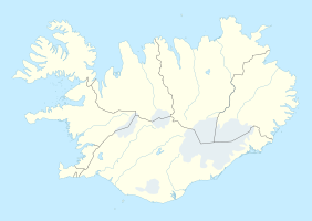
Gróttuviti is a lighthouse on the island of Grótta at the tip of the Seltjarnarnes peninsula in southwest Iceland .
The first lighthouse on Grótta was built in 1897 and replaced by a new one in 1947. His lantern was installed in the Súgandisey lighthouse in Stykkishólmur a year later . The new lighthouse is a 23 m high, white, conical concrete building with a red lantern house and was designed by engineer Axel Sveinsson (1896–1957).
The first lighthouse keeper was Þorvarður Einarsson. After his death, the post was passed on to his son Albert in 1931, until he drowned in 1970. The lighthouse has been unoccupied since then.
The identification is three flashes of one second length at an interval of 20 seconds. The sectors are: green (25 ° to 67 °), white (67 ° to 217 °), red (217 ° to 281 °) and green (281 ° to 294 °). The range is 15 nautical miles for the white and thirteen nautical miles for the colored light.
Web links
- Sabine Burger, Alexander Schwarz: Grótta - the lighthouse island near Seltjarnarnes in the online travel guide www.inreykjavik.is
Individual evidence
- ↑ Lighthouse Explorer on the Lighthouse Digest Magazine website , accessed April 13, 2017
- ↑ Saga Gróttu at www.seltjarnarnes.is, accessed on April 13, 2017 (Icelandic)
- ↑ Grótta lighthouse (island off the end of the Seltjarnarnes peninsula) ( Memento from April 13, 2017 in the Internet Archive ) on Phares du Monde (English)
- ^ List of Lights, Radio Aids and Fog Signals. Pub. 115 - Norway, Iceland and Arctic Ocean (PDF; 2.66 MB), National Geospatial-Intelligence Agency, Springfield, Virginia, 2016, p. 283 (English)

