Gressenhall
| Gressenhall | ||
|---|---|---|
| Coordinates | 52 ° 42 ' N , 0 ° 54' E | |
| OS National Grid | TF964166 | |
|
|
||
| Residents | 1008 (as of: 2001) | |
| surface | 10.53 km² (4.07 mi² ) | |
| Population density | 95.7 inhabitants / km² | |
| administration | ||
| Post town | DEREHAM | |
| ZIP code section | NR20 | |
| Part of the country | England | |
| region | East of England | |
| Shire county | Norfolk | |
| District | Breckland | |
| Civil Parish | Gressenhall | |
| Website: http://www.gressenhall.net | ||
Congress Hall is a civil parish in the District of Breckland in Norfolk , England. It is 10.53 square kilometers and had 1008 inhabitants at the 2001 census. Gressenhall is on the Whitewater River near East Dereham .
history
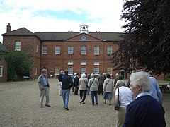
Gressenhall is home to the Gressenhall Farm and Workhouse Museum , the main building of which was built in 1776 and opened in 1777. At that time it was already an industrial building that served to give work and accommodation to alms recipients.
Web links
Commons : Gressenhall - Collection of images, videos and audio files

