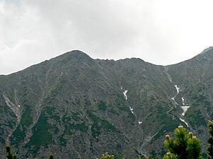
Great Ratzenberg
| Great Ratzenberg | ||
|---|---|---|
| height | 2037.6 m | |
| location | Slovakia | |
| Mountains | High Tatras | |
| Coordinates | 49 ° 12 '16 " N , 20 ° 14' 11" E | |
|
|
||
The Great Ratzenberg ( Slovak Veľká Svišťovka , Hungarian Nagy Morgás ) is a mountain in the High Tatras . The name refers to the fact that marmots , or Ratzen in Zipserdeutsch , are abundant here.
topography
The Große Ratzenberg is located in the northeast of the Kesmarker Spitze massif, at the end of a short ridge that runs from the Weber Spitze to the east and protrudes into the Kesmarker Weißwassertal ( Dolina Bielej vody ). In front of it is the Kleine Ratzenberg. The Leitbach ( Huncovský potok ) rises on the slopes between the Großer Ratzenberg and the Hunsdorfer Spitze . Traces of mining have been preserved on the slopes.
Ascent
From the Ratzenbergjoch ( Sedlo pod Svišťovkou ) the summit of the Großer Ratzenberg is easy to reach. The Tatra Magistrale between Steinseetal and Kesmarker Weißwassertal leads around the summit.
The Ratzenbergjoch can be reached
- from Steinsee ( Skalatne pleso ) in 1:20, along the red Tatra highway, on the slopes of the Hunsdorfer tip along
- from the hut at the Kesmarker Green Lake ( Zelené pleso kežmarské ). The Kesmarker Green Lake is from Tatra-Matlarenau ( Tatranske Matliare ) and Tatralomnitz ( Tatranská Lomnica ) via a blue marking to the Nad Matliarmi fork, and then further with a yellow marking over the cress fountain ( Salviovy pramen ).
From the summit, the blue markings lead in a south-easterly direction to the Kleiner Ratzenberg ( Malá Svišťovka , 1515 m) and the Forberger Blöse meadow ( Folwarska Polana ).
proof
- ↑ Václav Klumpar: High Tatras: The most beautiful valley and mountain walks. 50 tours. With GPS tracks . Bergverlag Rother GmbH.

