
Gyala Peri
| Gyala Peri | ||
|---|---|---|
 View of the north side |
||
| height | 7294 m | |
| location | Tibet Autonomous Region ( China ) | |
| Mountains | Assam Himalayas | |
| Dominance | 20.41 km → Namjagbarwa II | |
| Notch height | 2942 m | |
| Coordinates | 29 ° 48 '47 " N , 94 ° 58' 3" E | |
|
||
| First ascent | October 30, 1986 by Y. Hashimoto, H. Imamura and Y. Ogata | |

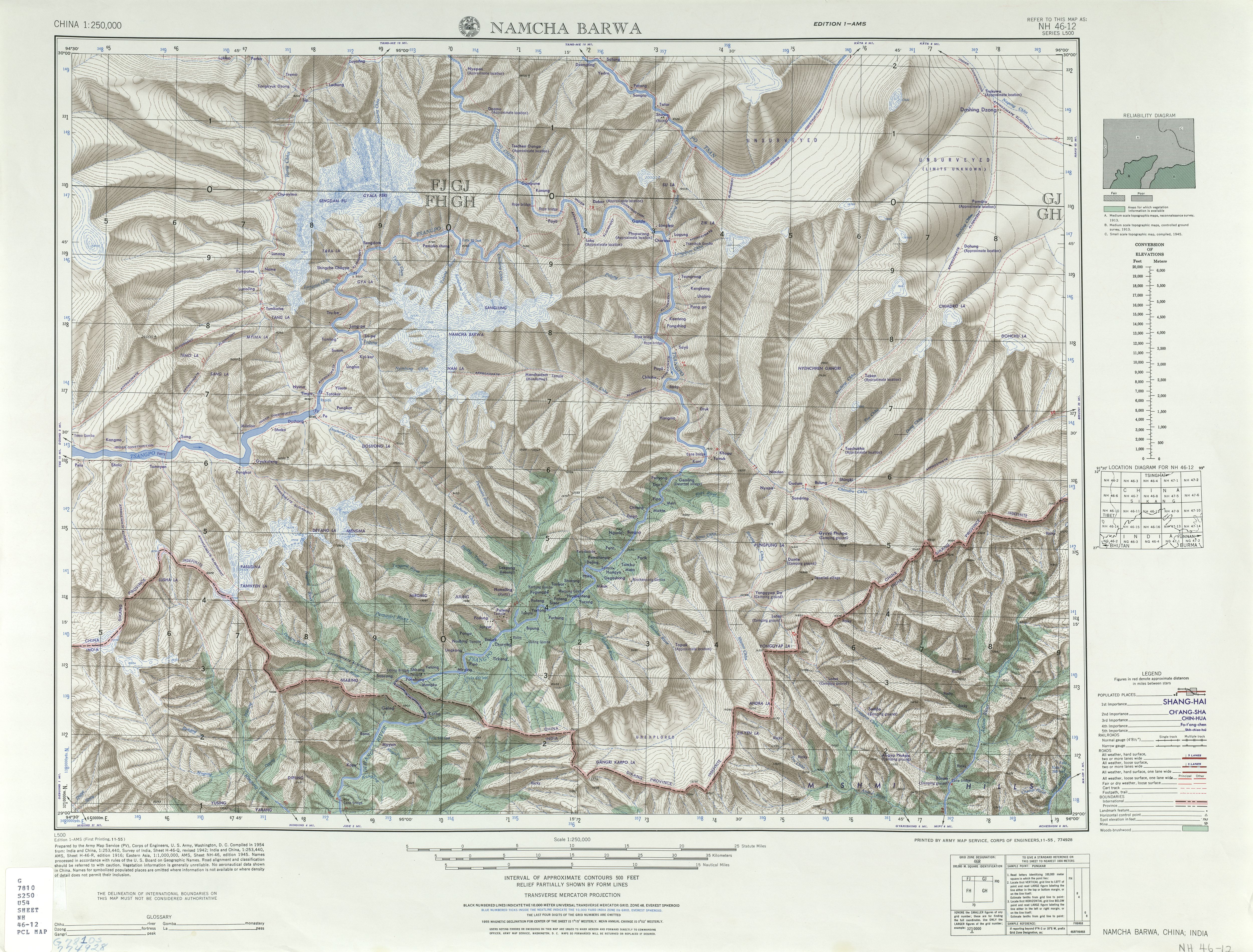
The Gyala Peri ( Chinese : 加拉 白 垒 , Pinyin : Jiālābáilěi ) is at 7294 m the second highest peak of the easternmost foothills of the Himalayas .
Even higher is Namjagbarwa, 22 km to the south, at 7782 m. The Gyala Peri is located in Mêdog County ( me tog rdzong མེ་ཏོག་ རྫོང ། / Mòtuō Xiàn 墨脱 县 ) in the Nyingchi administrative district of the Tibet Autonomous Region in the People's Republic of China . Both mountains enclose the large bend of the Yarlung Zangbo , also known as "Zangbo" or "Tsangpo" for short ("The Cleansing One"). It forms the upper reaches of the Brahmaputra , which is why the place is also called the Yarlung Zangpo / Brahmaputra loop. This is also the entrance to the Dihang gorges , in which the river rapidly decreases in height. The narrow gorge between the mountains is considered the world's largest and inaccessible.
To date, the area is largely unknown due to its inaccessibility. The Chinese are exploring the area, but logistical difficulties and climatic conditions are major obstacles. One of the questions that moves research is how and why the almost 3000 kilometers long Himalaya ends here as a mountain unit.
Ascent history
The first ascent of the summit took place in 1986 by a Japanese expedition over the south ridge. This dragged on for over a month. In Himalayan Index of the UK Alpine Club's no further climbs are listed.
Dam project
The government authorities had considered setting up a "Yarlung Tsangpo Grand Canyon" national park at the northeastern point of the river bend around the mountains Gyala Peri and Namjagbarwa, but these plans were rendered obsolete by a dam project to generate electricity. It is to be 160 m high and, with 26 turbines and a planned output of 40,000 MW, would be the largest hydroelectric power plant in the world. This controversial project has received great criticism, especially from India, as the villages along the river would be permanently affected.
literature
- Blanche C. Olschak, Augusto Gansser , Emil M. Bührer, Himalaya - Growing Mountains, Living Myths, Wandering People, vgs, ISBN 3-8025-2218-4
Web links
- Gyala Peri on Peakbagger.com (English)
- US Army Map Service (1955), 1: 250,000. Retrieved March 26, 2012
- summitpost.org
Individual evidence
- ↑ 7294 m instead of the often mentioned 7150 m
- ↑ Into the untreveled Himalaya , p. 39
- ^ The New Largest Canyon in the World - The Great Canyon of Yarlung Tsangpo River (Tibet) . ( Memento from February 28, 2008 in the Internet Archive )
- ↑ Blanche C. Olschak, Augusto Gansser, Emil M. Bührer: Himalaya - Growing Mountains, Living Myths, Wandering People (see Lit.)
- ^ Himalayan Index . Alpine Club Library
- ^ Tashi Tsering: Hydro Logic: Water for Human Development. An Analysis Of China'S Water Management and Politics. (PDF; 909 kB; 53 S.) Tibet Justice Center, 2002, p. 21
- ↑ Giant dam at Yarlung Tsangpo . In: Berliner Zeitung , June 3, 2010
- ↑ Water fight at Yarlung Tsangpo
- ↑ bibcode : 2007AGUFM.H11C0644Z
- ↑ Chinese engineers propose world's biggest hydro-electric project in Tibet
- ^ Let the Brahmaputra Flow. ( Memento from June 21, 2006 in the Internet Archive ) Tibet Environmental Watch - Editorial