
Hünenburg (Stadtlohn)
| Hünenburg | ||
|---|---|---|
 Outer wall with moat. |
||
| Alternative name (s): | Wittekindsburg | |
| Creation time : | Carolingian (8th century AD) | |
| Castle type : | Niederungsburg | |
| Conservation status: | Earth walls and hollows | |
| Place: | Bockwinkel, city wages | |
| Geographical location | 52 ° 0 '25.2 " N , 6 ° 52' 37.2" E | |
| Height: | 46 m above sea level NHN | |
|
||

The Hünenburg , also called Hünenburg near Wessendorf or Wittekindsburg , is a medieval hill fort near Stadtlohn in the Borken district in North Rhine-Westphalia . The forest area surrounding the Hünenburg is not far from the Berkel in the so-called Bockwinkel, around three kilometers northwest of the city center.
The Wallburg was designated as a ground monument in 1983 .
description
The Hünenburg is recognizable as a double wall system. All of the ramparts were accompanied by trenches on the outside, which are still recognizable today as hollows. Overall, the system is comparatively well preserved. Remains of any buildings have not been preserved.
The inner facility is around 1.7 hectares in size and is surrounded by earth walls that rise up to six meters above the bottom of the hollow. In the southeast, near a boulder on which a metal plaque indicates the facility, there is a passage at the site of a former pincer gate - here the walls are drawn inwards. The interior of the nuclear facility is significantly higher than the area between the inner and outer walls. On the west side, below the inner wall, a small stream flows north to the Berkel.
The outer walls are less thick than those of the core complex. They rise up to two meters above the surrounding area and cover an area of 8.5 hectares. The poor condition of the outer ramparts suggests that they were built before the ramparts of the inner complex. In the north-east of the plant, another rampart, today still around one meter high, branches off from the outer works, which runs in a north-westerly direction up to a Berkel loop.
While the walls of the inner complex are still in place except for a small interruption in the south-west, the outer walls are more impaired. This applies in particular to the western area, where there is now an agricultural operation.
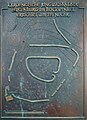
Notice board on the boulder in front of the entrance to the facility.

The inner wall sloping down to the stream.

Entrance to the core area with a rampart on the left.


history
There are just as few written sources about the origins and function of the Wallburg as there is evidence of its first owner. Today, based on finds and excavations, it is assumed that it is a Carolingian complex from the second half of the eighth century. The extension of the outer ramparts also fits well with other Carolingian complexes from the time of the Saxon Wars of Charlemagne . However, it could also have served to secure the Hellweg in front of the Santforde , which led from the Rhine and IJssel via Stadtlohn and Rheine to northern Germany. There are also speculations that put the Hünenburg in connection with the county of Hamaland . What is certain is that the facility has been modified and expanded several times.
The internal structure appears to be younger and could be late Carolingian or Ottonian . The construction of smaller, more or less rectangular ramparts within older existing structures was quite typical of this era. They often served several purposes, such as administration, road safety and as a refuge .
The Hünenburg, which was laid out in historical times, stands on a much older site, which was used as an urn burial site during the Bronze and Iron Ages .
Web links
literature
- Christiane Ruhmann: The Hünenburg near Stadtlohn, Borken district . Ed .: LWL - Antiquities Commission for Westphalia (= Early Castles in Westphalia . Volume 23 ). Munster 2004.