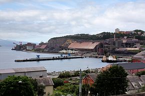
Narvik harbor
| Narvik harbor | |||
|---|---|---|---|
| Data | |||
| UN / LOCODE | NO-NVK | ||
| Port type | seaport | ||
| website | www.narvikhavn.no | ||
| Geographic information | |||
| place | Narvik | ||
| province | North country | ||
| Country | Norway | ||
| Coordinates | 68 ° 25 '19 " N , 17 ° 24' 29" E | ||
|
|||
The port of Narvik is a seaport in Norway . It is located north of the Arctic Circle .
geography
The harbor is located at the eastern (inner) end of the Ofotfjord ( Norwegian: Ofotfjorden ). The fjord is 78 kilometers long and up to 553 meters deep. Because of the Gulf Stream , the port is ice-free all year round and well protected from the elements.
history
Narvik was a Hurtigruten port from 1936 to 1953 .
The Battle of Narvik during World War II was about control of the ore railway and control of the port.
Goods and transport
Narvik has been the main port for shipping iron ore from the Swedish city of Kiruna since 1902 . The iron ore from the pits of the mining company LKAB is delivered via the ore railway. The deep-water port is also of central importance as a transport and logistics hub .
See also
Web links
- Narvik Havn KF Official website (Norwegian, English)

