Kiruna
| Kiruna | ||||
|
||||
| State : | Sweden | |||
| Province (län): | Norrbotten County | |||
| Historical Province (landskap): | Lapland | |||
| Municipality : | Kiruna | |||
| Coordinates : | 67 ° 51 ′ N , 20 ° 13 ′ E | |||
| SCB code : | 8676 | |||
| Status: | Crime scene | |||
| Residents : | 17,037 (December 31, 2015) | |||
| Area : | 9.03 km² | |||
| Population density : | 1887 inhabitants / km² | |||
| List of perpetrators in Norrbotten County | ||||
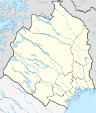
Kiruna is the northernmost city in Sweden . The main town of the municipality of the same name is located in the province of Norrbotten County and the historic province of Lapland . The name comes from the North Sami word giron - the North Sami name for the city - for ptarmigan , which is depicted in the city's coat of arms.
Kiruna was created as a settlement for the iron ore mine of the same name . So that the deposits below the city can be mined, it will be completely relocated five kilometers to the east by 2040 .
geography
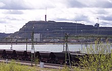
Kiruna lies between the two ore mountains Kiirunavaara (749 m above sea level) and Luossavaara (729 m), where high-quality magnetite iron ore with 60 to 70 percent iron content was found. To the west of the city is Lake Luossajärvi . The Kiruna ground station for communication with ESA satellites is around 30 km east of the city , the Esrange rocket launch site for the launch of civil research missiles.
The city is north of the Arctic Circle . The midnight sun shines continuously for 50 days from June to July. In winter there are 20 days of polar night : from December 12th through December 31st the sun never rises completely above the horizon .
In summer the temperatures in Kiruna are between 8 and 16 degrees (in July). The winters are cold, the daytime temperatures in January are between −9 and −15 degrees. On clear, windless nights it can go down to below −30 ° C.
| Kiruna | ||||||||||||||||||||||||||||||||||||||||||||||||
|---|---|---|---|---|---|---|---|---|---|---|---|---|---|---|---|---|---|---|---|---|---|---|---|---|---|---|---|---|---|---|---|---|---|---|---|---|---|---|---|---|---|---|---|---|---|---|---|---|
| Climate diagram | ||||||||||||||||||||||||||||||||||||||||||||||||
| ||||||||||||||||||||||||||||||||||||||||||||||||
|
Average monthly temperatures and rainfall for Kiruna
Source: WMO
|
|||||||||||||||||||||||||||||||||||||||||||||||||||||||||||||||||||||||||||||||||||||||||||||||||||||||||
History of Kiruna
With the construction of the ore railway , the ore finds known before at Kiirunavaara and Luossavaara could be mined. A settlement developed around the Luossavaare railway station, which was renamed Kiruna in 1900. Kiruna was raised to a minority in 1908 . In 1948 the community Jukkasjärvi , to which the place Kiruna belonged, was renamed Kiruna and raised to the status of town . Samething , the parliamentary representation of the Sami people, has been meeting there since 1993 .
The former name Luossavaara the first time in 1736 as Luosawara occupied and arose from the acquisition of the Sami word Luossavárri into Finnish, in turn, a composition , from the word for salmon '(North Sami luossa ) and the word for' mountain '(North Sami várri is). The name originally went from the nearby lake Luossajárvi ( járvi for lake) to the one ore mountain and was the name of the place until 1900. The current Swedish name of the place is derived from the Finnish form Kiiruna , which in turn is a translation of the Sami word Giron (snow grouse). Originally only the second ore mountain Kiirunavaara ( Berget Kieruna , 1736) was meant.
Ore mining and its consequences
The ore mining takes place in a volcanic exhalative deposit that runs diagonally under the city. At present (2008) the Swedish mining company LKAB extracts around 24 million tons of raw ore annually.
As the dismantling progresses , the districts above it become unsafe areas, so that it will be necessary to relocate the population within the next few decades . The alternative to resettlement would be to stop mining and thus the economic basis of the city.
In January 2007, the Kiruna City Council passed a resolution that the city must be "moved" accordingly. The city center of Kiruna must be moved four kilometers within the next few decades so that it is not endangered by collapses. The plan was to move the railroad west of Mount Kiirunavaara. The settlements would be built step by step further northwest of the existing city, so that the maintenance of the infrastructure would be relatively easy. In this way, Kiruna would have shifted a few kilometers from its current position over the next 50 to 100 years.
In June 2010 it was decided to build a new city center five kilometers further east . The relocation master plan presented in 2014 provides for the city to move gradually by 2033. The wooden church built by Gustaf Wickman in 1912 - which was built in the shape of a Sami kote from birch trunks - is to be completely preserved and moved to a new location. For some buildings, the state has lifted the monument protection. The listed town hall, which was built from 1959 to 1962 according to plans by the architect Artur von Schmalensee, is demolished because it would be more expensive to move than to build a new one. The new town hall is to be built according to the plans of the Danish architectural office Henning Larsen Architects .
On May 18, 2020, one of the strongest earthquakes ever recorded in Sweden occurred in the city with a magnitude of 4.9 m b . People were not harmed. According to geologist Björn Lund from Uppsala University , the tremors were related to mining.
traffic
An important transport link is the railway line from Luleå via Gällivare , Kiruna to Narvik , which was completed in 1903, officially inaugurated by King Oskar II on July 14, 1903 and fully electrified by 1915 . From there, the ore transported from Kiruna on the Malmbanan ("ore railway", referred to by the Norwegians as "Ofotbanen") is shipped. The Luleå – Narvik route is 473 kilometers. In the direction of Luleå it is used five times a day and in the opposite direction four times a day. This route is an important train connection for freight transport within Scandinavia.
In addition to the Malmbanan, there is a direct night train from Stockholm to Kiruna and back.
The city is on Europastraße 10 . Kiruna also has an airport that is served several times a day by SAS and Norwegian Air Shuttle .
tourism
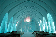
Kiruna offers a wide range of activities for vacationers. In summer they can hike, canoe, hunt and fish, in winter go skiing and dog sledding or go on hikes with snowshoes. The highest mountain in Sweden, the Kebnekaise , is not far. Well known is the Ice Hotel in Jukkasjärvi, which is rebuilt every year from October and opens in December.
The church of Kiruna , built entirely of wood, is worth seeing, which was built in 1912 by Gustaf Wickman based on the shape of a Sami kote. The altarpiece, which was painted by Prince Eugene of Sweden and shows a sun-drenched landscape, is particularly impressive . The church was voted the most beautiful building in Sweden in 2001.
The Kåppashålagrotte, one of the longest grotto systems in Sweden, is worth a visit. After entering, underground waterfalls can be admired. The mine museum provides information about 100 years of history and the development of the mine.
For some time now, the LKAB has been offering guided tours through an exhibition mine. The bus goes from the Kiruna Tourist Office to the exhibition mines (not all are open for viewing). There you can see how iron ore is extracted 500 m underground. A guide explains how the ore is processed with slide shows. The tour is offered daily, but only if there is sufficient demand from September to May. For safety reasons, children must be at least six years old and 1.1 m tall to enter the mine; Furthermore, the visitor must be able to speak Swedish or English in order to be able to follow the security staff in an emergency.
Another attraction are the tours of the rocket launch site Esrange , which take place at certain times .
Commercial space flights are to start from Kiruna in a few years. Originally, 2012 was the earliest date. The flights will be operated by Virgin Galactic in cooperation with Spaceport Sweden.
Sports
The local football club Kiruna FF was on the move to the 1st Swedish league ( Allsvenskan ) in 1991 and is currently playing in the Div. III Norra Norrland (5th division).
The city's ice hockey team, Kiruna IF, plays in the Div. I Norra, the third highest ice hockey class in Sweden.
Personalities
sons and daughters of the town
- Sigvard Eklund (1911–2000), scientist, second general director of the International Atomic Energy Agency
- Börje Salming (* 1951), former ice hockey player
- Göte Wälitalo (* 1956), former ice hockey goalkeeper and current coach
- Åsa Larsson (* 1966), crime writer; some of her crime novels are in and about Kiruna
- Carl Boutard (* 1975), sculptor, lives and works in Malmö and Berlin
- Mathias Edenborn (* 1975), musical actor
- Ylva Stålnacke (* 1992), alpine ski racer
- Hanna Öberg (* 1995), biathlete
- Elvira Öberg (* 1999), biathlete
People who worked in Kiruna
- Hans Holmér (1930–2002), commissioner and lawyer
- Karl Holmström (1925–1974), former ski jumper
- Gustaf Wickman (1858-1916), architect
Web links
- Official website of the city (English, Swedish)
- Tourist information (English, Swedish)
Individual evidence
- ↑ a b Statistiska centralbyrån : Land area per Tatort, folkmängd and invånare per square kilometer. Vart femte år 1960 - 2015 (database query)
- ↑ Archived copy ( Memento of the original from January 21, 2012 in the Internet Archive ) Info: The archive link was inserted automatically and has not yet been checked. Please check the original and archive link according to the instructions and then remove this notice.
- ↑ http://www.norrmagazin.de/design-architektur/kiruna-eine-stadt-macht-mobil/
- ↑ http://www.schiemann-web.de/reisebericht/stockholm/klimatabelle-schweden.htm
- ↑ Svenskt local dictionary . Språk- och folkminnesinstitutet, Uppsala 2003, ISBN 91-7229-020-X , p. 199
- ↑ Svenskt local dictionary . P. 167
- ↑ Lisbeth Pekkari: The beginning of the city transformation ( Memento from October 24, 2014 in the Internet Archive ). In: kiruna.se . 15th January 2014.
- ↑ Reinhard Wolff: Swedish city gives way to mining: in four years everything will be gone . In: The daily newspaper: taz . January 4, 2019, ISSN 0931-9085 ( taz.de [accessed March 1, 2019]).
- ↑ Swedish city plans to move. In: orf.at . October 23, 2014, accessed May 18, 2020.
- ↑ Oliver Wainwright: Kiruna: the town being moved 3km east so it doesn't fall into a mine. In: theguardian.com . October 22, 2014, accessed October 24, 2014.
- ^ Marianne Nordmark: City in transformation ( Memento from June 4, 2017 in the Internet Archive ). In: kiruna.se . June 27, 2016.
- ↑ Jordskalv i Kiruna - Kraftigaste i Sverige på tolv år. In: aftonbladet.se . May 18, 2020, accessed May 18, 2020 (Swedish).
- ↑ M 4.9 - 3km E of Kiruna, Sweden. USGS , accessed May 18, 2020.
- ↑ http://www.lkab.com/
- ↑ Homepage of Spaceport Sweden ( Memento from July 22, 2011 in the Internet Archive )


