Karesuando
| Karesuando | ||||
|
||||
| State : | Sweden | |||
| Province (län): | Norrbotten County | |||
| Historical Province (landskap): | Lapland | |||
| Municipality : | Kiruna | |||
| Coordinates : | 68 ° 26 ' N , 22 ° 29' E | |||
| SCB code : | 8664 | |||
| Status: | Crime scene | |||
| Residents : | 280 (December 31, 2015) | |||
| Area : | 0.74 km² | |||
| Population density : | 378 inhabitants / km² | |||
| Height : | 331 m above sea level | |||
| List of perpetrators in Norrbotten County | ||||
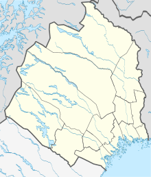
Karesuando ( Finnish : Karesuvanto , Sami : Gárasavvon ) is a place ( tätort ) in the northern Swedish province of Norrbotten County and the historic province of Lapland . It is located about 300 km north of the Arctic Circle in the municipality of Kiruna .
The small town is located directly on the Muonio River , which also forms a natural border with Finland . The Swedish part of Karesuando is connected to the Finnish part of Karesuvanto (140 inhabitants, 450 together) on the opposite side of the river via a bridge. In Karesuando - Sweden's northernmost crime scene - the European route 45 begins , Sweden's longest trunk road, which connects to the European route 8 in the neighboring Finnish municipality .
Sweden's northernmost church is in Karesuando. It was built in 1816, almost completely collapsed in 1866 and was rebuilt in 1905. The church was last renovated in 1953–1954.
Climate table
|
Average monthly temperatures and rainfall for Karesuando
Source: wetterkontor.de
|
|||||||||||||||||||||||||||||||||||||||||||||||||||||||||||||||||||||||||||||||||||||||||||||||||||||||||||||||||||||||||||||||||||||||||||||||||||||||||||||||||||||
Personalities
- Max Andersson (* 1962), comic artist


