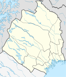
Kuttainen
| Kuttainen | ||||
|
||||
| State : | Sweden | |||
| Province (län): | Norrbotten County | |||
| Historical Province (landskap): | Lapland | |||
| Municipality : | Kiruna | |||
| Coordinates : | 68 ° 23 ' N , 22 ° 49' E | |||
| SCB code : | 8704 | |||
| Status: | Crime scene | |||
| Residents : | 218 (December 31, 2015) | |||
| Area : | 0.57 km² | |||
| Population density : | 382 inhabitants / km² | |||
| List of perpetrators in Norrbotten County | ||||
Kuttainen ( North Sami Guhttás ) is a place ( tätort ) in the Swedish province of Norrbotten County and the historic province of Lapland . He belongs to the Kiruna community .
The village with 218 inhabitants (2015) is located on the Muonio älven , right on the border with Finland . The Riksväg 99 leads through the farming village.
Web links
- Website of the locality (Swedish)
