Kurravaara
| Kurravaara | ||||
|
||||
| State : | Sweden | |||
| Province (län): | Norrbotten County | |||
| Historical Province (landskap): | Lapland | |||
| Municipality : | Kiruna | |||
| Coordinates : | 67 ° 57 ′ N , 20 ° 22 ′ E | |||
| SCB code : | S9183 | |||
| Status: | Småort | |||
| Residents : | 136 (December 31, 2015) | |||
| Area : | 0.86 km² | |||
| Population density : | 158 inhabitants / km² | |||
| Height : | 322 m above sea level | |||
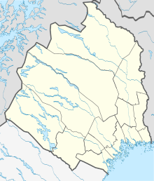
Kurravaara ( meänkieli and Swedish ; North Sami Gurravárri ) is a village ( Småort ) in the northern Swedish part of Lapland and the Tornetal , about 12 km north-northeast of Kiruna and 15 km upstream from Jukkasjärvi .
The place is located between the eponymous mountain (604 m) in the south and Kallovaara in the north in an indentation of the widened Torne älv called Kallojärvi, on the north bank of which is the neighboring village of Piksinranta .
Copper ore was mined here in the past at a geologically interesting interface between different parts of the Baltic Shield . Today the place offers means of transport, accommodation and holiday homes on both sides of the river.
Picture gallery
Personalities
- Erik August Larsson (1912–1982), cross-country skier

