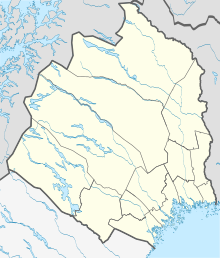
Tuolluvaara
| Tuolluvaara | ||||
|
||||
| State : | Sweden | |||
| Province (län): | Norrbotten County | |||
| Historical Province (landskap): | Lapland | |||
| Municipality : | Kiruna | |||
| Coordinates : | 67 ° 51 ′ N , 20 ° 20 ′ E | |||
| SCB code : | 8890 | |||
| Status: | Crime scene | |||
| Residents : | 979 (December 31, 2015) | |||
| Area : | 0.68 km² | |||
| Population density : | 1440 inhabitants / km² | |||
| List of perpetrators in Norrbotten County | ||||
Tuolluvaara ( Meänkieli Tuolla , Northern Sami Duolluvárri ) is a place ( tätort ) in the northern Swedish province of Norrbotten County and the historic province of Lapland north of the Arctic Circle .
History and description
The place was named after the mountain Tuolluvaara . The place is about 4 km east of the city center of Kiruna. Iron ore was found in Tuolluvaara in 1897. In 1903 ore mining began by Tuolluvaara Gruv AB . Ore mining ended in the 1980s. The approx. 76 m high round former winding tower is the landmark of Tuolluvaara.
The new city center of Kiruna is currently being built in Tuolluvaara. The place is connected to the Swedish road network via the European route 45 . Kiruna Airport is located on the southeast edge of Tuolluvaara .
Picture gallery
Web links
Commons : Tuolluvaara - collection of images, videos and audio files


