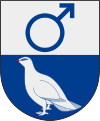
Kiruna (municipality)
| Kiruna parish | |||||
|---|---|---|---|---|---|
|
|||||
| State : | Sweden | ||||
| Province (län): | Norrbotten County | ||||
| Historical Province (landskap): | Lapland | ||||
| Main place: | Kiruna | ||||
| SCB code: | 2584 | ||||
| Residents : | 22,867 (December 31, 2019) | ||||
| Area : | 20,551.5 km² (January 1, 2016) | ||||
| Population density : | 1.1 inhabitants / km² | ||||
| Website : | www.kiruna.se | ||||
| List of municipalities in Sweden | |||||
Coordinates: 67 ° 51 ' N , 20 ° 13' E
Kiruna is a municipality ( Swedish kommun ) in the northern Swedish province of Norrbotten County and the historic province of Lapland . It is the northernmost municipality in Sweden.
The main town of the municipality is Kiruna . In addition to Kiruna, there are five larger localities ( tatorter ) in the municipality : Abisko , Jukkasjärvi , Karesuando , Kuttainen and Svappavaara . European roads 10 and 45 ( Inlandsvägen ) and the ore railway (Malmbanan) between Luleå and Narvik run through the municipality .
geography
With over 20,000 km² including inland waters, Kiruna is the largest municipality in Sweden in terms of area (slightly smaller than Hesse ). It extends about 160 kilometers along the Norwegian border in the west and 140 kilometers along the Finnish border in the northeast.
The rivers Torne älv , Lainioälven , Könkämäälven and Muonio älv flow from the high mountains in a south-easterly direction , with the latter two forming the border with Finland.
About half of the municipal area is taken up by the high mountain landscape in the northwest. Sweden's highest mountain, the Kebnekaise , and the Abisko and Vadvetjåkka national parks are located here . The southeast of the municipality is covered by extensive coniferous forests.
religion
The Catholics in Kiruna are assigned to the parish of St. Joseph , based in Luleå ; Catholic services take place monthly in the rooms of the Salvation Army in Kiruna.
economy
The municipality's economy is dominated by the mining company LKAB . Other important industries are space research and tourism. The research facilities in Kiruna include the Institute of Space Physics, the Esrange rocket launch site , Svenska Rymdaktiebolaget, Satellitbild AB and others.
Traditional reindeer herding also plays a certain role with around 700 reindeer herders.
Attractions
17 km east of the city of Kiruna, which has an interesting architectural history, is Jukkasjärvi , which houses an old church from 1726 and an ice hotel in winter . Karesuando , 170 km east of Kiruna on the Finnish border, is Sweden's northernmost church village with a predominantly Sami population. In Karesuando there is also the Lestadii pörte parsonage of the important revival preacher Lars Levi Læstadius .
About 100 km northwest of Kiruna is Sweden's seventh largest lake, the Torneträsk , on which the tourist centers Abisko and Björkliden are located. From Abisko, the Kungsleden long-distance hiking trail leads into the mountains and to Kebnekaise , the highest mountain in Sweden. The Låktatjåkko Fjällstation is the highest mountain hut in Sweden. Further west on the Norwegian border, Riksgränsen is particularly interesting for winter sports enthusiasts.
Partnerships
-
 Arkhangelsk ( Russia ), since August 9, 1999
Web links
- Official website (Swedish, German, English, Sami)
Individual evidence
- ↑ Folkmängd i riket, län och kommuner December 31, 2019 at Statistiska centralbyrån
- ↑ Kommunarealer January 1, 2016 at Statistiska centralbyrån (including all inland waters)


