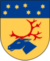
Arvidsjaur (municipality)
| Arvidsjaur municipality | |||||
|---|---|---|---|---|---|
|
|||||
| State : | Sweden | ||||
| Province (län): | Norrbotten County | ||||
| Historical Province (landskap): | Lapland | ||||
| Main place: | Arvidsjaur | ||||
| SCB code: | 2505 | ||||
| Residents : | 6220 (December 31, 2019) | ||||
| Area : | 6,126.3 km² (January 1, 2016) | ||||
| Population density : | 1 inhabitant / km² | ||||
| Website : | www.arvidsjaur.se | ||||
| List of municipalities in Sweden | |||||
Coordinates: 65 ° 36 ′ N , 19 ° 11 ′ O Arvidsjaur is a municipality ( Swedish commun ) in northern Sweden in the administrative province of Norrbotten County , 110 km south of the Arctic Circle in the historic province of Lapland .
Most of the inhabitants live in the main town Arvidsjaur , the rest in the suburbs of the municipality. The European route 45 ( Inlandsvägen ) and the imperial roads 94 and 95 ( Silvervägen ) run through the municipality . The Inlandsbahn and Tvärbanan meet at Arvidsjaur station .
Residents
Around 20 Sami families still live according to the traditional way of life in the community today .
history
Arvidsjaur was not permanently settled by Swedish settlers until 1757.
region
There are around 4,000 lakes in the municipality of Arvidsjaur and nature is home to 15,000 reindeer . There are also brown bears and moose in large game .
Nature reserves
- Jan-Svensa Mountain
- Vittjakk-Akkanalke Reserve
- Reivo primeval forest reserve
- Tjadnereservat
economy
The K4, an elite military regiment, is stationed in Arvidsjaur.
Attractions
- Storforsen , one of the largest European whitewater
- Trollforsen , waterfall
- In summer, train rides take place under steam.
- Lappstaden
Museums
Web links
swell
- ↑ Folkmängd i riket, län och kommuner December 31, 2019 at Statistiska centralbyrån
- ↑ Kommunarealer January 1, 2016 at Statistiska centralbyrån (including all inland waters)


