
Domestic railway
| Gällivare – Östersund – Kristinehamn | |||||||||||||||||||||||||||||||||||||||||||||||||||||||||||||||||||||||||||||||||||||||||||||||||||||||||||||||||||||||||||||||||||||||||||||||||||||||||||||||||||||||||||||||||||||||||||||||||||||||||||||||||||||||||||||||||||||||||||||||||||||||||||||||||||||||||||||||||||||||||||||||||||||||||||||||||||||||||||||||||||||||||||||||||||||||||||||||||||||||||||||||||||||||||||||||||||||||||||||||||||||||||||||||||||||||||||||||||||||||||||||||||||||||||||||||||||||||||||||||||||||||||||||||||||||||||||||||||||||||||||||||||||||||||||||||||||||||||||||||||||||||||||||||||||||||||||||||||||||||||||||||||||||||||||||||||||||||||||||||||||||||||||||||||||||||||||||||||||||||||||||||||||||||||||||||||||||||||||||||||||||||||||||||||||||||||||||||||||||||||||||||||||||||||||||||||||||||||||||||||||||||||||||||||||||||||||||||||||||||||||||||||||||||||||||||||||||||||||||||||||||||||||||||||||||||||||||||||||||||||||||||||||||||||||||||||||||||||||||||||||||||||||||||||||||||||||||||||||||||
|---|---|---|---|---|---|---|---|---|---|---|---|---|---|---|---|---|---|---|---|---|---|---|---|---|---|---|---|---|---|---|---|---|---|---|---|---|---|---|---|---|---|---|---|---|---|---|---|---|---|---|---|---|---|---|---|---|---|---|---|---|---|---|---|---|---|---|---|---|---|---|---|---|---|---|---|---|---|---|---|---|---|---|---|---|---|---|---|---|---|---|---|---|---|---|---|---|---|---|---|---|---|---|---|---|---|---|---|---|---|---|---|---|---|---|---|---|---|---|---|---|---|---|---|---|---|---|---|---|---|---|---|---|---|---|---|---|---|---|---|---|---|---|---|---|---|---|---|---|---|---|---|---|---|---|---|---|---|---|---|---|---|---|---|---|---|---|---|---|---|---|---|---|---|---|---|---|---|---|---|---|---|---|---|---|---|---|---|---|---|---|---|---|---|---|---|---|---|---|---|---|---|---|---|---|---|---|---|---|---|---|---|---|---|---|---|---|---|---|---|---|---|---|---|---|---|---|---|---|---|---|---|---|---|---|---|---|---|---|---|---|---|---|---|---|---|---|---|---|---|---|---|---|---|---|---|---|---|---|---|---|---|---|---|---|---|---|---|---|---|---|---|---|---|---|---|---|---|---|---|---|---|---|---|---|---|---|---|---|---|---|---|---|---|---|---|---|---|---|---|---|---|---|---|---|---|---|---|---|---|---|---|---|---|---|---|---|---|---|---|---|---|---|---|---|---|---|---|---|---|---|---|---|---|---|---|---|---|---|---|---|---|---|---|---|---|---|---|---|---|---|---|---|---|---|---|---|---|---|---|---|---|---|---|---|---|---|---|---|---|---|---|---|---|---|---|---|---|---|---|---|---|---|---|---|---|---|---|---|---|---|---|---|---|---|---|---|---|---|---|---|---|---|---|---|---|---|---|---|---|---|---|---|---|---|---|---|---|---|---|---|---|---|---|---|---|---|---|---|---|---|---|---|---|---|---|---|---|---|---|---|---|---|---|---|---|---|---|---|---|---|---|---|---|---|---|---|---|---|---|---|---|---|---|---|---|---|---|---|---|---|---|---|---|---|---|---|---|---|---|---|---|---|---|---|---|---|---|---|---|---|---|---|---|---|---|---|---|---|---|---|---|---|---|---|---|---|---|---|---|---|---|---|---|---|---|---|---|---|---|---|---|---|---|---|---|---|---|---|---|---|---|---|---|---|---|---|---|---|---|---|---|---|---|---|---|---|---|---|---|---|---|---|---|---|---|---|---|---|---|---|---|---|---|---|---|---|---|---|---|---|---|---|---|---|---|---|---|---|---|---|---|---|---|---|---|---|---|---|---|---|---|---|---|---|---|---|---|---|---|---|---|---|---|---|---|---|---|---|---|---|---|---|---|---|---|---|---|---|---|---|---|---|---|---|---|---|---|---|---|---|---|---|---|---|---|---|---|---|---|---|---|---|---|---|---|---|---|---|---|---|---|---|---|---|---|---|---|---|---|---|---|---|---|---|---|---|---|---|---|---|---|---|---|---|---|---|---|---|---|---|---|---|---|---|---|---|---|---|---|---|---|---|---|---|---|---|---|---|---|---|---|---|---|---|---|---|---|---|---|---|---|---|---|---|---|---|---|---|---|---|---|---|---|---|---|---|---|---|---|---|---|---|---|---|---|---|---|---|---|---|---|---|---|---|---|---|---|---|---|---|---|---|---|---|---|---|---|---|---|---|---|---|---|---|---|---|---|---|---|---|---|---|---|---|---|---|---|---|---|---|---|---|---|---|---|---|---|---|---|---|---|---|---|---|---|---|---|---|---|---|---|---|---|---|---|---|---|---|---|---|---|---|---|---|---|---|---|---|---|---|---|---|---|---|---|---|---|---|---|---|---|---|---|---|---|---|---|---|---|---|---|---|---|---|---|---|---|---|---|---|---|---|---|---|---|---|---|---|---|---|---|---|---|---|---|---|---|---|---|---|---|---|---|---|---|---|---|---|---|---|---|---|---|---|---|---|---|---|---|---|---|---|---|---|---|---|---|---|---|---|---|---|---|---|---|---|---|---|---|---|---|---|---|---|---|---|---|---|---|---|---|---|---|---|---|---|---|---|---|---|---|---|---|---|---|---|---|---|---|---|---|---|---|---|---|---|---|---|---|---|---|---|---|---|---|---|---|---|---|---|---|---|---|---|---|---|---|---|---|---|---|---|---|---|---|---|---|---|---|---|---|---|---|---|---|---|---|---|---|---|---|---|---|---|---|---|---|---|---|
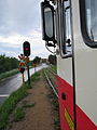
 Two railcars meet in Sorsele
| |||||||||||||||||||||||||||||||||||||||||||||||||||||||||||||||||||||||||||||||||||||||||||||||||||||||||||||||||||||||||||||||||||||||||||||||||||||||||||||||||||||||||||||||||||||||||||||||||||||||||||||||||||||||||||||||||||||||||||||||||||||||||||||||||||||||||||||||||||||||||||||||||||||||||||||||||||||||||||||||||||||||||||||||||||||||||||||||||||||||||||||||||||||||||||||||||||||||||||||||||||||||||||||||||||||||||||||||||||||||||||||||||||||||||||||||||||||||||||||||||||||||||||||||||||||||||||||||||||||||||||||||||||||||||||||||||||||||||||||||||||||||||||||||||||||||||||||||||||||||||||||||||||||||||||||||||||||||||||||||||||||||||||||||||||||||||||||||||||||||||||||||||||||||||||||||||||||||||||||||||||||||||||||||||||||||||||||||||||||||||||||||||||||||||||||||||||||||||||||||||||||||||||||||||||||||||||||||||||||||||||||||||||||||||||||||||||||||||||||||||||||||||||||||||||||||||||||||||||||||||||||||||||||||||||||||||||||||||||||||||||||||||||||||||||||||||||||||||||||||
| Route number : |
Kristinehamn – Persberg: 69 Persberg – Vika: without Vika – Mora: 54 Mora – Östersund – Gällivare: 99 |
||||||||||||||||||||||||||||||||||||||||||||||||||||||||||||||||||||||||||||||||||||||||||||||||||||||||||||||||||||||||||||||||||||||||||||||||||||||||||||||||||||||||||||||||||||||||||||||||||||||||||||||||||||||||||||||||||||||||||||||||||||||||||||||||||||||||||||||||||||||||||||||||||||||||||||||||||||||||||||||||||||||||||||||||||||||||||||||||||||||||||||||||||||||||||||||||||||||||||||||||||||||||||||||||||||||||||||||||||||||||||||||||||||||||||||||||||||||||||||||||||||||||||||||||||||||||||||||||||||||||||||||||||||||||||||||||||||||||||||||||||||||||||||||||||||||||||||||||||||||||||||||||||||||||||||||||||||||||||||||||||||||||||||||||||||||||||||||||||||||||||||||||||||||||||||||||||||||||||||||||||||||||||||||||||||||||||||||||||||||||||||||||||||||||||||||||||||||||||||||||||||||||||||||||||||||||||||||||||||||||||||||||||||||||||||||||||||||||||||||||||||||||||||||||||||||||||||||||||||||||||||||||||||||||||||||||||||||||||||||||||||||||||||||||||||||||||||||||||||||
| Course book range : |
Kristinehamn – Nykroppa: 78 Mora – Östersund: 37 Östersund – Gällivare: 38 |
||||||||||||||||||||||||||||||||||||||||||||||||||||||||||||||||||||||||||||||||||||||||||||||||||||||||||||||||||||||||||||||||||||||||||||||||||||||||||||||||||||||||||||||||||||||||||||||||||||||||||||||||||||||||||||||||||||||||||||||||||||||||||||||||||||||||||||||||||||||||||||||||||||||||||||||||||||||||||||||||||||||||||||||||||||||||||||||||||||||||||||||||||||||||||||||||||||||||||||||||||||||||||||||||||||||||||||||||||||||||||||||||||||||||||||||||||||||||||||||||||||||||||||||||||||||||||||||||||||||||||||||||||||||||||||||||||||||||||||||||||||||||||||||||||||||||||||||||||||||||||||||||||||||||||||||||||||||||||||||||||||||||||||||||||||||||||||||||||||||||||||||||||||||||||||||||||||||||||||||||||||||||||||||||||||||||||||||||||||||||||||||||||||||||||||||||||||||||||||||||||||||||||||||||||||||||||||||||||||||||||||||||||||||||||||||||||||||||||||||||||||||||||||||||||||||||||||||||||||||||||||||||||||||||||||||||||||||||||||||||||||||||||||||||||||||||||||||||||||||
| Route length: | 1288 km | ||||||||||||||||||||||||||||||||||||||||||||||||||||||||||||||||||||||||||||||||||||||||||||||||||||||||||||||||||||||||||||||||||||||||||||||||||||||||||||||||||||||||||||||||||||||||||||||||||||||||||||||||||||||||||||||||||||||||||||||||||||||||||||||||||||||||||||||||||||||||||||||||||||||||||||||||||||||||||||||||||||||||||||||||||||||||||||||||||||||||||||||||||||||||||||||||||||||||||||||||||||||||||||||||||||||||||||||||||||||||||||||||||||||||||||||||||||||||||||||||||||||||||||||||||||||||||||||||||||||||||||||||||||||||||||||||||||||||||||||||||||||||||||||||||||||||||||||||||||||||||||||||||||||||||||||||||||||||||||||||||||||||||||||||||||||||||||||||||||||||||||||||||||||||||||||||||||||||||||||||||||||||||||||||||||||||||||||||||||||||||||||||||||||||||||||||||||||||||||||||||||||||||||||||||||||||||||||||||||||||||||||||||||||||||||||||||||||||||||||||||||||||||||||||||||||||||||||||||||||||||||||||||||||||||||||||||||||||||||||||||||||||||||||||||||||||||||||||||||||
| Gauge : | 1435 mm ( standard gauge ) | ||||||||||||||||||||||||||||||||||||||||||||||||||||||||||||||||||||||||||||||||||||||||||||||||||||||||||||||||||||||||||||||||||||||||||||||||||||||||||||||||||||||||||||||||||||||||||||||||||||||||||||||||||||||||||||||||||||||||||||||||||||||||||||||||||||||||||||||||||||||||||||||||||||||||||||||||||||||||||||||||||||||||||||||||||||||||||||||||||||||||||||||||||||||||||||||||||||||||||||||||||||||||||||||||||||||||||||||||||||||||||||||||||||||||||||||||||||||||||||||||||||||||||||||||||||||||||||||||||||||||||||||||||||||||||||||||||||||||||||||||||||||||||||||||||||||||||||||||||||||||||||||||||||||||||||||||||||||||||||||||||||||||||||||||||||||||||||||||||||||||||||||||||||||||||||||||||||||||||||||||||||||||||||||||||||||||||||||||||||||||||||||||||||||||||||||||||||||||||||||||||||||||||||||||||||||||||||||||||||||||||||||||||||||||||||||||||||||||||||||||||||||||||||||||||||||||||||||||||||||||||||||||||||||||||||||||||||||||||||||||||||||||||||||||||||||||||||||||||||||
| Route class : |
Mora – Östersund – Arvidsjaur: D Arvidsjaur – Gällivare: C |
||||||||||||||||||||||||||||||||||||||||||||||||||||||||||||||||||||||||||||||||||||||||||||||||||||||||||||||||||||||||||||||||||||||||||||||||||||||||||||||||||||||||||||||||||||||||||||||||||||||||||||||||||||||||||||||||||||||||||||||||||||||||||||||||||||||||||||||||||||||||||||||||||||||||||||||||||||||||||||||||||||||||||||||||||||||||||||||||||||||||||||||||||||||||||||||||||||||||||||||||||||||||||||||||||||||||||||||||||||||||||||||||||||||||||||||||||||||||||||||||||||||||||||||||||||||||||||||||||||||||||||||||||||||||||||||||||||||||||||||||||||||||||||||||||||||||||||||||||||||||||||||||||||||||||||||||||||||||||||||||||||||||||||||||||||||||||||||||||||||||||||||||||||||||||||||||||||||||||||||||||||||||||||||||||||||||||||||||||||||||||||||||||||||||||||||||||||||||||||||||||||||||||||||||||||||||||||||||||||||||||||||||||||||||||||||||||||||||||||||||||||||||||||||||||||||||||||||||||||||||||||||||||||||||||||||||||||||||||||||||||||||||||||||||||||||||||||||||||||||
| Power system : |
Kristinehamn – Nykroppa, Mora – Morastrand and Brunflo – Östersund V: 15 kV 16.7 Hz ~ |
||||||||||||||||||||||||||||||||||||||||||||||||||||||||||||||||||||||||||||||||||||||||||||||||||||||||||||||||||||||||||||||||||||||||||||||||||||||||||||||||||||||||||||||||||||||||||||||||||||||||||||||||||||||||||||||||||||||||||||||||||||||||||||||||||||||||||||||||||||||||||||||||||||||||||||||||||||||||||||||||||||||||||||||||||||||||||||||||||||||||||||||||||||||||||||||||||||||||||||||||||||||||||||||||||||||||||||||||||||||||||||||||||||||||||||||||||||||||||||||||||||||||||||||||||||||||||||||||||||||||||||||||||||||||||||||||||||||||||||||||||||||||||||||||||||||||||||||||||||||||||||||||||||||||||||||||||||||||||||||||||||||||||||||||||||||||||||||||||||||||||||||||||||||||||||||||||||||||||||||||||||||||||||||||||||||||||||||||||||||||||||||||||||||||||||||||||||||||||||||||||||||||||||||||||||||||||||||||||||||||||||||||||||||||||||||||||||||||||||||||||||||||||||||||||||||||||||||||||||||||||||||||||||||||||||||||||||||||||||||||||||||||||||||||||||||||||||||||||||||
| Maximum slope : | 17 ‰ | ||||||||||||||||||||||||||||||||||||||||||||||||||||||||||||||||||||||||||||||||||||||||||||||||||||||||||||||||||||||||||||||||||||||||||||||||||||||||||||||||||||||||||||||||||||||||||||||||||||||||||||||||||||||||||||||||||||||||||||||||||||||||||||||||||||||||||||||||||||||||||||||||||||||||||||||||||||||||||||||||||||||||||||||||||||||||||||||||||||||||||||||||||||||||||||||||||||||||||||||||||||||||||||||||||||||||||||||||||||||||||||||||||||||||||||||||||||||||||||||||||||||||||||||||||||||||||||||||||||||||||||||||||||||||||||||||||||||||||||||||||||||||||||||||||||||||||||||||||||||||||||||||||||||||||||||||||||||||||||||||||||||||||||||||||||||||||||||||||||||||||||||||||||||||||||||||||||||||||||||||||||||||||||||||||||||||||||||||||||||||||||||||||||||||||||||||||||||||||||||||||||||||||||||||||||||||||||||||||||||||||||||||||||||||||||||||||||||||||||||||||||||||||||||||||||||||||||||||||||||||||||||||||||||||||||||||||||||||||||||||||||||||||||||||||||||||||||||||||||||
| Top speed: |
Bandel 361: Vika– (Mora): 40 km / h freight trains: 70 km / h, railcars: 105 km / h |
||||||||||||||||||||||||||||||||||||||||||||||||||||||||||||||||||||||||||||||||||||||||||||||||||||||||||||||||||||||||||||||||||||||||||||||||||||||||||||||||||||||||||||||||||||||||||||||||||||||||||||||||||||||||||||||||||||||||||||||||||||||||||||||||||||||||||||||||||||||||||||||||||||||||||||||||||||||||||||||||||||||||||||||||||||||||||||||||||||||||||||||||||||||||||||||||||||||||||||||||||||||||||||||||||||||||||||||||||||||||||||||||||||||||||||||||||||||||||||||||||||||||||||||||||||||||||||||||||||||||||||||||||||||||||||||||||||||||||||||||||||||||||||||||||||||||||||||||||||||||||||||||||||||||||||||||||||||||||||||||||||||||||||||||||||||||||||||||||||||||||||||||||||||||||||||||||||||||||||||||||||||||||||||||||||||||||||||||||||||||||||||||||||||||||||||||||||||||||||||||||||||||||||||||||||||||||||||||||||||||||||||||||||||||||||||||||||||||||||||||||||||||||||||||||||||||||||||||||||||||||||||||||||||||||||||||||||||||||||||||||||||||||||||||||||||||||||||||||||||
| Operating points and routes | |||||||||||||||||||||||||||||||||||||||||||||||||||||||||||||||||||||||||||||||||||||||||||||||||||||||||||||||||||||||||||||||||||||||||||||||||||||||||||||||||||||||||||||||||||||||||||||||||||||||||||||||||||||||||||||||||||||||||||||||||||||||||||||||||||||||||||||||||||||||||||||||||||||||||||||||||||||||||||||||||||||||||||||||||||||||||||||||||||||||||||||||||||||||||||||||||||||||||||||||||||||||||||||||||||||||||||||||||||||||||||||||||||||||||||||||||||||||||||||||||||||||||||||||||||||||||||||||||||||||||||||||||||||||||||||||||||||||||||||||||||||||||||||||||||||||||||||||||||||||||||||||||||||||||||||||||||||||||||||||||||||||||||||||||||||||||||||||||||||||||||||||||||||||||||||||||||||||||||||||||||||||||||||||||||||||||||||||||||||||||||||||||||||||||||||||||||||||||||||||||||||||||||||||||||||||||||||||||||||||||||||||||||||||||||||||||||||||||||||||||||||||||||||||||||||||||||||||||||||||||||||||||||||||||||||||||||||||||||||||||||||||||||||||||||||||||||||||||||||||
|
|||||||||||||||||||||||||||||||||||||||||||||||||||||||||||||||||||||||||||||||||||||||||||||||||||||||||||||||||||||||||||||||||||||||||||||||||||||||||||||||||||||||||||||||||||||||||||||||||||||||||||||||||||||||||||||||||||||||||||||||||||||||||||||||||||||||||||||||||||||||||||||||||||||||||||||||||||||||||||||||||||||||||||||||||||||||||||||||||||||||||||||||||||||||||||||||||||||||||||||||||||||||||||||||||||||||||||||||||||||||||||||||||||||||||||||||||||||||||||||||||||||||||||||||||||||||||||||||||||||||||||||||||||||||||||||||||||||||||||||||||||||||||||||||||||||||||||||||||||||||||||||||||||||||||||||||||||||||||||||||||||||||||||||||||||||||||||||||||||||||||||||||||||||||||||||||||||||||||||||||||||||||||||||||||||||||||||||||||||||||||||||||||||||||||||||||||||||||||||||||||||||||||||||||||||||||||||||||||||||||||||||||||||||||||||||||||||||||||||||||||||||||||||||||||||||||||||||||||||||||||||||||||||||||||||||||||||||||||||||||||||||||||||||||||||||||||||||||||||||||
| Persberg – Filipstad (–Nykroppa) New line since 1964 |
|||||||||||||||||||||||||||||||||||||||||||||||||||||||||||||||||||||||||||||||||||||||||||||||||||||||||||||||||||||||||||||||||||||||||||||||||||||||||||||||||||||||||||||||||||||||||||||||||||||||||||||||||||||||||||||||||||||||||||||||||||||||||||||||||||||||||||||||||||||||||||||||||||||||||||||||||||||||||||||||||||||||||||||||||||||||||||||||||||||||||||||||||||||||||||||||||||||||||||||||||||||||||||||||||||||||||||||||||||||||||||||||||||||||||||||||||||||||||||||||||||||||||||||||||||||||||||||||||||||||||||||||||||||||||||||||||||||||||||||||||||||||||||||||||||||||||||||||||||||||||||||||||||||||||||||||||||||||||||||||||||||||||||||||||||||||||||||||||||||||||||||||||||||||||||||||||||||||||||||||||||||||||||||||||||||||||||||||||||||||||||||||||||||||||||||||||||||||||||||||||||||||||||||||||||||||||||||||||||||||||||||||||||||||||||||||||||||||||||||||||||||||||||||||||||||||||||||||||||||||||||||||||||||||||||||||||||||||||||||||||||||||||||||||||||||||||||||||||||||||
| Route number : | Kristinehamn – Persberg: 69 | ||||||||||||||||||||||||||||||||||||||||||||||||||||||||||||||||||||||||||||||||||||||||||||||||||||||||||||||||||||||||||||||||||||||||||||||||||||||||||||||||||||||||||||||||||||||||||||||||||||||||||||||||||||||||||||||||||||||||||||||||||||||||||||||||||||||||||||||||||||||||||||||||||||||||||||||||||||||||||||||||||||||||||||||||||||||||||||||||||||||||||||||||||||||||||||||||||||||||||||||||||||||||||||||||||||||||||||||||||||||||||||||||||||||||||||||||||||||||||||||||||||||||||||||||||||||||||||||||||||||||||||||||||||||||||||||||||||||||||||||||||||||||||||||||||||||||||||||||||||||||||||||||||||||||||||||||||||||||||||||||||||||||||||||||||||||||||||||||||||||||||||||||||||||||||||||||||||||||||||||||||||||||||||||||||||||||||||||||||||||||||||||||||||||||||||||||||||||||||||||||||||||||||||||||||||||||||||||||||||||||||||||||||||||||||||||||||||||||||||||||||||||||||||||||||||||||||||||||||||||||||||||||||||||||||||||||||||||||||||||||||||||||||||||||||||||||||||||||||||||
| Route length: | 24 km | ||||||||||||||||||||||||||||||||||||||||||||||||||||||||||||||||||||||||||||||||||||||||||||||||||||||||||||||||||||||||||||||||||||||||||||||||||||||||||||||||||||||||||||||||||||||||||||||||||||||||||||||||||||||||||||||||||||||||||||||||||||||||||||||||||||||||||||||||||||||||||||||||||||||||||||||||||||||||||||||||||||||||||||||||||||||||||||||||||||||||||||||||||||||||||||||||||||||||||||||||||||||||||||||||||||||||||||||||||||||||||||||||||||||||||||||||||||||||||||||||||||||||||||||||||||||||||||||||||||||||||||||||||||||||||||||||||||||||||||||||||||||||||||||||||||||||||||||||||||||||||||||||||||||||||||||||||||||||||||||||||||||||||||||||||||||||||||||||||||||||||||||||||||||||||||||||||||||||||||||||||||||||||||||||||||||||||||||||||||||||||||||||||||||||||||||||||||||||||||||||||||||||||||||||||||||||||||||||||||||||||||||||||||||||||||||||||||||||||||||||||||||||||||||||||||||||||||||||||||||||||||||||||||||||||||||||||||||||||||||||||||||||||||||||||||||||||||||||||||||
| Gauge : | 1435 mm ( standard gauge ) | ||||||||||||||||||||||||||||||||||||||||||||||||||||||||||||||||||||||||||||||||||||||||||||||||||||||||||||||||||||||||||||||||||||||||||||||||||||||||||||||||||||||||||||||||||||||||||||||||||||||||||||||||||||||||||||||||||||||||||||||||||||||||||||||||||||||||||||||||||||||||||||||||||||||||||||||||||||||||||||||||||||||||||||||||||||||||||||||||||||||||||||||||||||||||||||||||||||||||||||||||||||||||||||||||||||||||||||||||||||||||||||||||||||||||||||||||||||||||||||||||||||||||||||||||||||||||||||||||||||||||||||||||||||||||||||||||||||||||||||||||||||||||||||||||||||||||||||||||||||||||||||||||||||||||||||||||||||||||||||||||||||||||||||||||||||||||||||||||||||||||||||||||||||||||||||||||||||||||||||||||||||||||||||||||||||||||||||||||||||||||||||||||||||||||||||||||||||||||||||||||||||||||||||||||||||||||||||||||||||||||||||||||||||||||||||||||||||||||||||||||||||||||||||||||||||||||||||||||||||||||||||||||||||||||||||||||||||||||||||||||||||||||||||||||||||||||||||||||||||||
| Top speed: | 90 km / h | ||||||||||||||||||||||||||||||||||||||||||||||||||||||||||||||||||||||||||||||||||||||||||||||||||||||||||||||||||||||||||||||||||||||||||||||||||||||||||||||||||||||||||||||||||||||||||||||||||||||||||||||||||||||||||||||||||||||||||||||||||||||||||||||||||||||||||||||||||||||||||||||||||||||||||||||||||||||||||||||||||||||||||||||||||||||||||||||||||||||||||||||||||||||||||||||||||||||||||||||||||||||||||||||||||||||||||||||||||||||||||||||||||||||||||||||||||||||||||||||||||||||||||||||||||||||||||||||||||||||||||||||||||||||||||||||||||||||||||||||||||||||||||||||||||||||||||||||||||||||||||||||||||||||||||||||||||||||||||||||||||||||||||||||||||||||||||||||||||||||||||||||||||||||||||||||||||||||||||||||||||||||||||||||||||||||||||||||||||||||||||||||||||||||||||||||||||||||||||||||||||||||||||||||||||||||||||||||||||||||||||||||||||||||||||||||||||||||||||||||||||||||||||||||||||||||||||||||||||||||||||||||||||||||||||||||||||||||||||||||||||||||||||||||||||||||||||||||||||||||
|
|||||||||||||||||||||||||||||||||||||||||||||||||||||||||||||||||||||||||||||||||||||||||||||||||||||||||||||||||||||||||||||||||||||||||||||||||||||||||||||||||||||||||||||||||||||||||||||||||||||||||||||||||||||||||||||||||||||||||||||||||||||||||||||||||||||||||||||||||||||||||||||||||||||||||||||||||||||||||||||||||||||||||||||||||||||||||||||||||||||||||||||||||||||||||||||||||||||||||||||||||||||||||||||||||||||||||||||||||||||||||||||||||||||||||||||||||||||||||||||||||||||||||||||||||||||||||||||||||||||||||||||||||||||||||||||||||||||||||||||||||||||||||||||||||||||||||||||||||||||||||||||||||||||||||||||||||||||||||||||||||||||||||||||||||||||||||||||||||||||||||||||||||||||||||||||||||||||||||||||||||||||||||||||||||||||||||||||||||||||||||||||||||||||||||||||||||||||||||||||||||||||||||||||||||||||||||||||||||||||||||||||||||||||||||||||||||||||||||||||||||||||||||||||||||||||||||||||||||||||||||||||||||||||||||||||||||||||||||||||||||||||||||||||||||||||||||||||||||||||||
The Inlandsbanan ( German inland railway , literally translated Inlandsbahn ) is a railway line in Sweden , which is mostly operated by the railway company Inlandsbanan AB . It runs for more than 1288 km from Kristinehamn in the south to Gällivare in the north.
For a long time the railway line was of secondary importance for passenger traffic. Passenger transport was limited to the summer months - mainly tourists are transported here. Only slowly does a change set in again. In addition, the railway is also important for the transport of wood, natural resources and goods. In Gällivare the Inlandsbanan meets the ore railway , which connects Kiruna and the Norwegian Narvik in the north with Luleå and the Swedish Baltic coast in the south.
history
The history of the inland railway is themed in two museums, which are located in the reception buildings and goods sheds of the stations Sorsele ("Railway Museum of Inland Railway") and Moskosel ("Museum of Railway Workers").
construction
Initial considerations of opening up northern Sweden via an inland railway line go back to 1897. The first connection to the north was the Stambanan genom övre Norrland , which runs parallel to the east coast of Sweden. The military therefore raised concerns because this route was too vulnerable for attacks from the coast and therefore had to be supplemented by an inland route for supplies. Such a route also promised the economic development of the underdeveloped inland region in northern Sweden. The efforts for the construction were further strengthened by Norway's resolution from the personal union with the Swedish crown in 1905 (see: here ). The Swedish provinces of Härjedalen and Jämtland , which until then had been oriented towards Norway and the Atlantic coast , were now cut off from these connections by the new border. The inland railway became a "national project".

Jämtlands Sikås station (around 1915)

Hammerdal station (1920)

Trollforsen Station (1965)

Neva Railway Station (1925)

Persbergs gruva (1920)
.jpg)
.jpg)


In 1907, after the approval of the Reichstag for the construction of a railway line from Östersund to Ulriksfors , construction began. The construction was carried out by the state railway Statens Järnvägar (SJ). The two northern sections (Mora – Östersund and Östersund – Gällivare) were largely new sections. In the northern section, two short, existing sections between Mora and Orsa (13.5 km of the Orsa – Falun line ) and the almost 16 km long section from Brunflo to Östersund V, part of the Sundsvall – Storlien line, were included . In the middle section, the railway line Sveg – Orsa (–Mora) of Orsa – Härjeådalens Järnvägsaktiebolag , which was nationalized in 1919, was included. The southern section was the also as a private company established track Mora Kristinehamn the Östra Värmland Järnväg which was nationalized 1916th
The inland railway was built in sections over a period of around 30 years and gradually put into operation. As a rule, the individual sections were tackled by both sides at about the same time. In Kåbdalis in 1936 the then general director of the SJ, Axel Granholm , hammered the last nail into a sleeper , and on August 6, 1937, the then Crown Prince Gustav Adolf inaugurated this last section of the railway between Arvidsjaur and Jokkmokk . In his opening speech, however, there was a certain amount of skepticism about the future of the railways: “The construction that we are now completing ... marks the end of actual railroad construction in our country. ... Today we are in the middle of a new era in which it is a matter of expanding and improving our country road network. ” A memorial stone commemorates the event. From this point on, the inland railway was in full operation. The next major railway construction in Sweden was actually the Botniabahn - 60 years after the Crown Prince's address.
In 1964 major operational changes took place in the Filipstad area . These were related to the closure of the old line between Nykroppa and Persberg . The trains then drove from Hornkullen via Dagösen to Filipstad on the former route from Bergslagernas Järnvägar . A new eight-kilometer stretch was built between Filipstad and Persberg, the nya banan .
Since 1963 the Swedish state has pursued the policy of closing down “unprofitable” railway lines. The inland railway was only of secondary importance for passenger traffic. In 1988 the Swedish railway network was split into a core network and several regional networks. The Inlandsbahn was given a special position because of its special character. With the 1990/1991 timetable, passenger traffic was nevertheless to be completely shifted to bus traffic, which led to strong protests from residents. The abandonment of passenger transport was prevented by a parliamentary election with a change of government in 1991. As a result, the Inlandsbahn Committee was founded, which transferred the route to a regional sponsorship, in which the neighboring communities and the Swedish state jointly bear the costs. (The southern section was no longer continuously passable due to the closure of sections of the route and was not included.) The 15 neighboring communities founded a stock corporation to maintain the route , whose task it was ultimately to operate the route, to maintain it, to draw up a timetable and Manage investment funds. The financial responsibility for the railway infrastructure remained with the state. This railway company took over the railway line on April 1, 1993 from the SJ in a lease-like ratio.
The state authority that is responsible for the Swedish railway network after the dissolution of the SJ - Trafikverket in Borlänge - lists the domestic railway under the category “private railway”, but has assigned the route a route number , 99. Inlandsbanan AB is the responsible railway infrastructure company and at the same time one of the railway companies that allows trains to run on the route .
Opening dates
Northern part (Gällivare – Östersund):
- Lugnvik – Häggenås 35.3 km, October 1, 1911
- Östersund – Lugnvik 2.8 km, November 13, 1912
- Häggenås – Ulriksfors 77.2 km, December 1, 1912
- Jämtlands Sikås – Hammerdal 9.4 km, December 1, 1912
- Strömsund – Ulriksfors 4.3 km, December 1, 1912
- Ulriksfors – Hoting 51.6 km, November 1, 1914
- Hoting – Dorotea 21.1 km, November 1, 1915
- Porjus – Gällivare 53.0 km, December 1, 1917
- Dorotea – Vilhelmina 56.4 km, February 16, 1918
- Vilhelmina – Storuman 68.0 km, November 15, 1923
- Lövliden – Holmsele hamn 6.9 km, June 1, 1924 (provisionally as early as 1921)
- Jokkmokk – Porjus 47.3 km, November 21, 1927
- Storuman – Sorsele 72.0 km, December 1, 1929
- Sorsele – Arvidsjaur 87.5 km, December 1, 1933
- Arvidsjaur – Jokkmokk 173.4 km, August 7, 1937
Middle section (Östersund – Mora):
- Brunflo – Hackås 30.3 km, December 15, 1916
- Hackås – Svenstavik 21.3 km, December 15, 1917
- Svenstavik – Åsarna 15.3 km, July 1, 1918
- Åsarna – Sveg 102.3 km, September 21, 1922
- Mora Noret – Orsa 13.5 km, August 1, 1892
- Orsa – Bäckedal 121 km, November 30, 1908
- Bäckedal – Sveg 2 km, February 9, 1909
Southern part (Mora – Kristinehamn):
- Kristinehamn – Storfors, June 3, 1873
- Storfors – Gammalkroppa, December 11, 1875
- Gammalkroppa – Persberg / Finnshyttan, December 1, 1876
- Persberg – Oforsen, November 1, 1889
- Oforsen – Vansbro, November 1, 1890
- Vansbro – Mora, November 1, 1891

Memorial stone in Kåbdalis

Reindeer on the tracks

At Björnidet

Fågelsjö train station


business
traffic
Railway construction was completed at a time when road traffic began to take the lead. Even before the line was completed, passenger traffic was canceled: from May 28, 1932 to May 21, 1937 and from September 1, 1939 to November 30, 1943, there were no trains between Jämtlands Sikås and Hammerdal.
The high point of operations on the line was during the Second World War . The formally neutral Kingdom of Sweden nonetheless allowed the German Reich to transport troops and materials across its territory to Norway , Finland and the northern Soviet Union . Around two million German soldiers were transported on the domestic railway.
Accidents
Again and again there are clashes with wild animals. The most dangerous occurred when a freight train drove into a herd of reindeer near Arvidsjaur in 1972. In recent years there have been repeated reports of clashes: On June 30, 2013, the northbound railcar encountered a herd of 52 reindeer near Kåbdalis. In a collision with a moose in 1972, a railcar from the 1950s derailed near Svenstavik.
- Gällivare 1929 : On February 4, 1929, Zug 3792 collided with a wooden truck nine kilometers south of Gällivare in a heavy snowstorm. The train derailed.
- Trollforsen 1935 : On June 27, 1935 near Joddejaur shortly before the Trollforsen station, 12 km north of Moskosel , a 32-man work train drove into a group of shy horses. The train derailed , the locomotive overturned. 8 people died and at least 13 others were injured. A stele on the banks of the Abmoälven near the site of the accident commemorates the accident.
- Vikbäcken 1943 : On April 10, 1943, the local freight train with passenger transport derailed. The track structure was destroyed over a length of 100 m.
- Älvho 1950 : On June 2, 1950, 22 wagons of the local freight train 8416 derailed south of the Älvho.
- Akkavare 1956 : On March 28, 1956, the rail bus, train 1041, collided with the local freight train 8524. 16 people died and another 10 were injured.
- Storuman 1974 : On September 11, a work trip collided with the 71063 train. Two railroad workers died. The cause was excessive speed.
- Emådalen 1991 : Y1 1366 collided with a wooden truck on December 6th at an open level crossing. The railcar came to a stop across the tracks.
- Porjus 2013 : On September 27, 2013, part of a freight train derailed near Porjus, which was traveling from Kallholsfors (on the Orsa – Bollnäs railway line ) to Kiruna and which had loaded lime for the LKAB .
- Älvho 2013 : The peat train from Sveg on November 29, 2013 with the TMZ 1421 locomotive broke down on the open track. The requested auxiliary locomotive Td 401 collided with the stationary train. It was almost the same place as the 1950 accident.
- Rörström 2014 : On July 4, 2014, the limestone train between Hoting and Dorotea derailed, 200 meters of the track being destroyed and the line being interrupted for three days.
Operational settings
After 1950, the railway quickly lost its importance, just as the automobile and the European route 45 (at that time with different numbers, e.g. Länsväg 242, 296 and 343) gained in importance. Large parts of the line were closed, especially in the 1960s:
Northern part (Gällivare – Östersund):
- Lövliden – Holmsele hamn, Personenverkehr (PV) October 5, 1928,
- Holmsele – Holmsele hamn, total 1931
- Lövliden – Holmsele, total 1933
- Jämtlands Sikås – Hammerdal, PV May 28, 1932 to May 21, 1937 and September 1, 1939 to November 30, 1943
- Jämtlands Sikås – Hammerdal, PV November 1, 1957
- Jokkmokk – Kåbdalis, Freight Transport (GV) May 22, 1961
- Kåbdalis – Moskosel, GV May 31, 1964
- Ulriksfors – Strömsund, PV 23 May 1982 (summer traffic again in 2013)
- Jämtlands Sikås – Hammerdal, GV July 1, 1983
- Moskosel – Norra Kikkejaur, GA January 1, 1986
- Gällivare – Jokkmokk, GV May 25, 1989
Middle section (Östersund – Mora):
- Sveg – Hede, total February 1, 1966
Southern part (Mora – Kristinehamn):
- Persberg – Persbergs gruva, 1 km. PV January 1, 1917
- Persberg – Persbegs gruva, GV October 1, 1922 - connecting railway
- Filipstad Östra – Finnshyttan, 2 km. PV September 1, 1954
- Filipstad Östra – Finnshyttan, 2 km. General Assembly May 31, 1964
- Nyhyttan – Filipstad Östra, 8 km. Total May 31, 1964
- Nykroppa – Gåsgruvan, 16 km. Total May 31, 1964
- Gåsgruvan – Persberg, 2 km. PV May 31, 1964
- Mora – Vika, 11 km. PV September 1, 1969
- Vika – Dalasågen, 59 km. Total September 1, 1969
- Dalasågen – Vansbro, 2 km. Total September 1, 1969 - connecting railway
- Vansbro – Sågen, 31 km. Total September 1, 1969 (after Tretjärn until 1974?)
- Sågen – Lesjöfors, 33 km. PV September 1, 1969
- Sågen – Oforsen, 19 km. General Assembly June 17, 1974
- Gåsgruvan – Persberg, 2 km. General Meeting June 1, 1975
- Oforsen – Lesjöfors, 14 km. General Meeting January 1, 1979
- Lesjöfors – Persberg, PV September 2, 1985
- Lesjöfors – Persberg, GV December 1, 1986 (formally: October 1, 1989)
- Persberg – Filipstad, PV June 26, 2000
- Filipstad – Nykroppa, PV June 15, 2003
- Lomsmyren – Vika: “Underhåll har upphört” - no traffic, but no official closure
- Persberg – Filipstad: no traffic since 2012, but no legal effects
present
Route maintenance (central and northern sections)
passenger traffic
From the timetable change in December 2016, on the initiative and with financial support, passenger transport was again offered daily and all year round on the middle section - planned for four years: This consisted of a pair of trains for commuters between Åsarna and Östersund and one between Orsa and Mora. Two-part Pesa Link railcars were to be used. However, at the beginning of the 2017 summer timetable, the trips were stopped without a Pesa Link being seen. Inlandståg AB bought five Alstom Lint 41 railcars in February 2019 for use between Mora and Östersund. The railcars have 134 seats, which would be ideal for suburban traffic between Mora and Orsa. A conversion is planned for the long line between Mora and Östersund.
In the winter timetable there is a daily railcar from Östersund to Mora and back. In Mora there is a connection to the Intercity to and from Stockholm. The trips end at the end of the ski season at the end of April. Furthermore, in the winter high season, a continuous express train runs from southern Sweden via Östersund to Röjan and back on Sundays . In March 2019, this train was split over two weekends in Östersund and then ended in Storuman with stops in Dorotea and Vilhelmina.
Passenger transport was initially limited to the summer months and is geared entirely towards tourists. Continuous passenger traffic on the entire remaining route takes place only from June to August. In connection with Covid-19 , summer traffic in 2020 was completely stopped.
Arvidsjaurs Järnvägsförening
The Arvidsjaurs Järnvägsförening (railway club Arvidsjaur) has a series of historical railway vehicles . He regularly offers trains between Arvidsjaur and Slagnäs run by steam locomotives , as well as trips to the winter market in Jokkmokk in the historic Y7 class multiple units . On selected dates, special trains continue to run for the travel agency of Inlandsbanan AB (formerly Grand Nordic AB ) in the northern section.
Freight transport
Scheduled freight traffic takes place on the route between Östersund and Storuman. The most important economic factor for the route is the logging between Arvidsjaur and Mora. The rail transport company Green Cargo and the freight transport company Inlandståget AB, which belongs to Inlandsbanan AB, are leaders in freight transport on the entire route . Furthermore, lime has occasionally been transported almost over the entire route since 2013. Today, freight transport and tourism ensure that the route is economically maintained.
Infrastructure improvement
In the far north, the route was partly only very simply developed and had a low load-bearing capacity ( route class A). In 2012, the track superstructure between Jokkmokk and Kåbdalis was reinforced. The state provided 40 million Swedish kronor for this.
In February 2009 Inlandsbanan AB decided on a development plan. This provided for various extensions of the route. The first step was the expansion of the Arvidsjaur – Jokkmokk railway line from 16 t to 20 t axle load in 2012 - this means that the TMZ series can now also be used over the entire route. The Sveg – Brunflo section is to be expanded to 22.5 tonnes. In a further step, the top speed between Östersund and Storuman is to be increased to 100 km / h. From 2015 to 2025, 1.8 billion Swedish kronor (194 million euros) will be made available to the domestic railway for the infrastructure. This is expected to cover upkeep costs, but will not leave room for major improvements. Infranord is involved in route maintenance .

Steam train in Arvidsjaur

Train with old wagons

In Röjan

Langholz in Sveg

Kåbdalis station in winter


Southern section
Most of the traffic has stopped here; only the sections between Kristinehamn and Persberg and between Mora and Vika are still in operation. They are managed by Trafikverket and are currently operated by Tågåkeriet i Bergslagen AB (TÅGAB) and Green Cargo .
Since the track systems are mostly still available on the disused routes, bicycle trolleys are sometimes operated between Persberg and Lomsmyren . Intercity buses have taken over passenger transport here.
There is still freight traffic between Kristinehamn and Filipstad . Filipstad train station is served on weekdays except Tuesday and Saturday. The further stretch to Persberg has not been used since 2012, the following section via Vansbro to Vika has been closed. On October 19, 2011 the newspaper Dala-Democrats published an article on the future of the Persberg – Mora section. A resumption of freight traffic at a maximum speed of 40 km / h is being considered here.
On the south-western section of the Mora – Vika section, the 4 km long stretch between Lomsmyren and Vika, there has been no train traffic for several years due to deficiencies in the superstructure. Trafikverket therefore proposed in October 2013 that maintenance of this section of the route be stopped. If the authorities surveyed agree, the route will continue to exist for three years without maintenance. At the end of this period, if there is no longer any need, the section will be shut down for good. Current information - also on the takeover application of the entire southern section by Inlandsbanan AB - will not be available in 2020.
Route and landscape
While the main direction of the route runs from north to south, the rivers flow from the mountains west of the railway in an easterly direction to the Baltic Sea . As a result, numerous bridges had to be built along the route, and the mountain ridges that separate the river valleys lead to many bends in the route, with which they are bypassed and the route is then led back into the valleys. Overall, however, the topography is relatively flat, so that the route only has one tunnel; this is only 50 m long.
With the exception of the few cities on the line, it only touches villages, and some stops also exist for places that mainly consist of holiday homes. Due to this low degree of development of the landscape driven through, the route mostly crosses forests that become lighter towards the north. In the valleys, the train repeatedly runs along moors .
In Gällivare there is a connection between the inland railway and the ore railway , which connects Kiruna and the Norwegian Narvik in the north with Luleå and the Swedish Baltic coast in the south. A few kilometers south of Jokkmokk , the railway crosses the Arctic Circle . This is marked on both sides of the route with white painted stones, white poles and a large sign east of the route. Between Hoting and Dorotea , the route runs for kilometers across the river island Långön , making it the largest Swedish inland island with a railway line.
Structural features
Crossing over the Mankellbron : The traffic light is already showing , the railway signal is still red.

Train ride across the Piteälvsbron

Signal for “stop on request” at Fågelsjö station

Water intake point on the route near Älvho


Combined rail-road bridges
The inland railway still uses two combined rail-road bridges, on which the railroad and road traffic share one lane. These are the Mankellbron (Mankell Bridge) near Sveg and the Piteälvsbron (bridge over the Piteälven ) near Moskosel . There used to be other bridges of this type, such as the one over the Ångermanälven near Bränna or the Stora Luleälven near Porjus .
Such bridges were manned by a guard who stopped the traffic when trains were traveling. Both bridges now have a semi-automatic safety system that switches on a red flashing light for road traffic as soon as a train approaches. Only after the train has stopped and a railway worker has made sure that the bridge is free can the barrier system be closed at the push of a button and the railway signal switches to green.
Shape signals
A few stations along the route still have form signals , such as those in Moskosel, Buresjön and Kitajaur. They are only of operational importance in Moskosel. For this purpose, a special annex in the operating documents ("Linjebok") is necessary, as shape signals are no longer included in the Swedish signal book . In 2010, the entire local interlocking mechanism in Moskosel was overhauled.
Smallest train station in Sweden
The Buddnakk station is referred to in various travel guides as well as by the Inland Railway itself as the smallest train station in Sweden. The bus shelter is not much bigger than a toilet, and there is a short wooden platform. Buddnakk is not and was not included in the Inland Railway timetables. Buddnakk is served by the Arvidsjaurs Järnvägsförening steam train Arvidsjaur – Slagnäs .
Operational peculiarities
Route safety
The route safety is carried out by the northern train line from Trafikverket, based in Gävle, for the entire routes of Inlandsbanan AB. There is no block of tracks , the entrances and, in some cases, exits from the stations are secured by entry and exit signals , as are many level crossings at the same level . The drivers are in telephone contact with the train control center .
After accidents occurred in the past at train crossings at unoccupied stations (see for example above: Akkavare in 1956), today train crossings in the manual train protection system ("System M") are only permitted at stations that are manned by a dispatcher . Since it is usually not worthwhile to keep the stations permanently occupied with the low volume of traffic, dispatchers are dispatched to the relevant station at an upcoming train crossing. On the northern line, this applies to the Kåbdalis and Moskosel stations, for example.
In the last few years the conversion of important train stations to remote control has started. This means that a number of stations can be served by one of the three permanently manned stations - Sveg, Hoting and Storuman. For this purpose, new entry signals with additional intermediate and exit signals were set up. At the beginning of 2019, this will affect the Orsa, Fågelsjö, Röjan, Svenstavik, Sorsele, Arvidsjaur and Jokkmokk train stations.
Stop on demand
In sparsely populated northern Sweden, stops and small (unoccupied) train stations are equipped with a signal board - a yellow disc with a red border - which the traveler can turn so that the disc points in the direction of the approaching train. With this, those who want to get on show the driver that he should stop. The train stops and the signal has to be reset manually. This board is nicknamed Plåtstins , which means “sheet metal station inspector ”.

Ämån with a slide for rafting tree trunks
Route crosses the Arctic Circle

Memorial plaque at Östersund Central station with the signatures of King Carl XVI. Gustaf , Queen Silvia and Crown Princess Victoria of Sweden
Train protection system in Storuman


Cultural meaning
The route is the one in Sweden "around which most of the stories, myths, hopes and dreams entwine". It has been sung about and many stories and anecdotes are told about it. The Swedish monument protection ranks the railway line high today, as many of the facilities from the first half of the 20th century have largely been preserved unchanged. Reception buildings and goods sheds are usually type buildings made of wood in the local style .
literature
- Bengt Sandhammar: Inlandsbanan. Östersund 2014, ISBN 978-91-637-6788-3 .
- Christina Falkengård: Inlandsbanan. En resehandbok. Ostersund 1984.
- Inlandsbahnmuseum (Ed.): The Inlandsbahnmuseum Sorsele. [Flyer], undated <2014>.
- Katarina Sandberg, Harald Sundlin: Inlandsbanan. En järnväg genom den svenska historien - en framtidsväg genom Sverige. Riksantikvarieämbetet, Stockholm 2003.
- Peter Selin: Inlandsbanan. Idé och historia. Ostersund 1996.
- Association of Central European Railway Administrations (Hrsg.): Station directory of the railways of Europe . 52nd edition. Barthol & Co., Berlin-Wilmersdorf 1939 (formerly Dr. Koch's station directory).
Web links
- Inlandsbanan AB homepage with further information (German, English, Swedish)
- Inland Railway Line Book (PDF, Swedish)
- Inland Railway Timetable Summer / Winter (PDF)
- Inlandsbanan, English
- History at www.historiskt.nu (Swedish, a little English)
- Photos of the TMX locomotives at nohab-gm.de
- Östersund – Storuman – Arvidsjaur – Gällivare. Inlandsbanan. järnväg.net, accessed February 15, 2016 (Swedish).
- Mora – Sveg – Brunflo (–Östersund). Inlandsbanan. järnväg.net, accessed February 15, 2016 (Swedish).
- Kristinehamn-Filipstad-Vansbro-Mora. Inlandsbanan. järnväg.net, accessed February 15, 2016 (Swedish).
Individual evidence
- ↑ Våra spår. Bärighet. Inlandsbanan AB, accessed January 29, 2019 (Swedish).
- ↑ JNB 2019 Bilaga 3 E STH per sträcka. (PDF) Utgåva 2018–12–14. trafikverket.se, December 14, 2018, p. 134 , accessed on January 29, 2019 (Swedish).
- ↑ Järnvägsnätsbeskrivning 2017
- ↑ Linjebok Inlandsbanan, IBF 64: 1, ver. 2. (PDF) October 21, 2013, accessed July 1, 2014 (Swedish).
- ↑ a b c d e f g h i j k l m n o Association of Central European Railway Administrations (ed.): Station directory of the European railways . (formerly Dr. KOCH's station directory). 52nd edition. Barthol & Co., Berlin-Wilmersdorf 1939.
- ↑ SJ and the station sign designate the stop as "Morastrand", the Inland Railway uses the designation "Mora Strand". For both see current timetables.
- ↑ Järnvägshistoriskt forum Bangårdsskisser Herrhult. Retrieved July 1, 2014 (Swedish).
- ↑ In Swedish , the ending “-n” in nouns has the function of a specific article . The article die is also added because of the requirements of German grammar.
- ↑ Inlandsbahnmuseum, p. 2.
- ↑ a b c d Sandberg, p. 6.
- ↑ a b Sandberg, p. 10.
- ↑ Sandberg, S.?.
- ↑ a b Sandberg, p. 11.
- ↑ a b c d e Sandberg, p. 5.
- ↑ Quoted from: Sandberg, p. 24.
- ^ Renovation of Filipstad. In: jarnvag.net. Retrieved April 16, 2018 (Swedish).
- ↑ a b Sandberg, p. 76.
- ↑ runeberg.org
- ↑ historiskt.nu
- ↑ Sandhammar, p. 210.
- ↑ Sandhammar, p. 212.
- ↑ banvakt.se based on a text by the Moskosel Railway Museum (Swedish)
- ↑ Sandhammar, p. 212 f.
- ↑ Sandhammar, p. 213 f.
- ↑ a b Sandhammar, p. 217.
- ↑ Sandhammar, p. 211.
- ^ Eisenbahn-Revue International 11/2013, p. 584; jst: Another derailment on the Swedish national railway . In: Eisenbahn-Revue International 8–9 (2014), p. 416.
- ↑ The Tretjärn tank farm was served on a case-by-case basis for a few years. Sista tågen till Tretjärn
- ↑ historiskt.nu
- ↑ postvagnen.com
- ↑ postvagnen.com
- ↑ jst: Year -round operation on the inland railway from 2017. In: Eisenbahn-Revue International. 6/2016, p. 294.
- ↑ https://inlandsbanan.se/anvand/artikel/nya-tag
- ↑ Press release IBAB from June 24th, 2020 (Swedish)
- ↑ Arvidsjaurs Järnvägsförening (ed.): Arvidsjaurs Järnvägsförening. [Leaflet], undated (2014).
- ↑ Arvidsjaurs Järnvägsförening. (No longer available online.) Archived from the original on April 17, 2018 ; Retrieved April 16, 2018 (Swedish). Info: The archive link was inserted automatically and has not yet been checked. Please check the original and archive link according to the instructions and then remove this notice.
- ↑ Inlandsbahnmuseum, p. 4.
- ↑ Norrländska Social Democrats: Inlandsbanan måste rustas upp för att palla för trycket of February 21, 2012
- ↑ IBAB press release of February 28, 2012. (PDF) Archived from the original on June 28, 2013 ; accessed on February 15, 2016 .
- ↑ Inlandsbanan AB's 2009 development plan is no longer available online. Alternatively there is the development strategy 2013–2022
- ↑ mr / st: start of the season on the Inlandsbahn. In: Eisenbahn-Revue International. 7/2014, p. 335.
- ^ EU Railway Atlas. Schweers + Wall, Aachen 2013, p. 9.
- ↑ Filipstads Tidning: Fyra godståg per vecka körs från Filipstad ( Memento of October 14, 2017 in the Internet Archive ) of January 4, 2016
- ^ Dala Democrats: Nytt hopp för Inlandsbanan . August 1, 2012, archived from the original on August 1, 2012 ; accessed on April 16, 2018 .
- ↑ Indraget underhåll på flera järnvägssträckor ( Memento from March 9, 2016 in the Internet Archive )
- ^ Sandberg, p. 16.
- ↑ Linjebok Inlandsbanan AB
- ↑ Sandberg, p. 17 f.