Öreälven
|
Öreälven Öre älv, Örån |
||
| Data | ||
| location | Västerbottens län ( Sweden ) | |
| River system | Öreälven | |
| source | in Stöttingfjället 64 ° 45 ′ 18 ″ N , 17 ° 28 ′ 40 ″ E |
|
| muzzle | north of North Maling in the Gulf of Bothnia Coordinates: 63 ° 31 ′ 0 ″ N , 19 ° 44 ′ 0 ″ E 63 ° 31 ′ 0 ″ N , 19 ° 44 ′ 0 ″ E |
|
| Mouth height |
0 m o.h.
|
|
| length | 225 km | |
| Catchment area | 3,028.9 km² | |
| Drain |
MQ |
35 m³ / s |
| Right tributaries | Vargån | |
| Flowing lakes | Örträsksjön | |
| Communities | Bjurholm | |
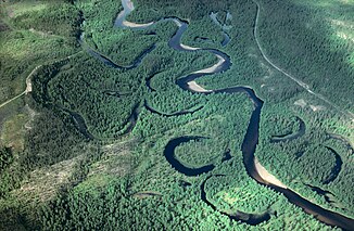
The Öreälven (also Öre älv ) is a Swedish river. In the upper reaches north of the lake Örträsksjön it is called Örån .
The headwaters of Örån are located in Lapland between Vilhelmina and Lycksele . From there it flows in a south-easterly direction to the Baltic Sea, where it flows into the Gulf of Bothnia after about 225 kilometers north of Nordmaling .
The Öreälven drains an area of 3,030 km² and has an average water flow of 35 m³ / s. Bjurholm is located on the Öreälven .
Individual evidence
- ↑ Sveriges Meteorologiska och Hydrologiska Institut (SMHI) - Län och huvudavrinningsområden i Sverige (PDF; 2.5 MB)
