
Vilhelmina
| Vilhelmina | ||||||
|
||||||
| State : | Sweden | |||||
| Province (län): | Västerbotten County | |||||
| Historical Province (landskap): | Lapland | |||||
| Municipality : | Vilhelmina | |||||
| Coordinates : | 64 ° 37 ′ N , 16 ° 39 ′ E | |||||
| SCB code : | 8376 | |||||
| Status: | Crime scene | |||||
| Residents : | 3572 (December 31, 2015) | |||||
| Area : | 3.29 km² | |||||
| Population density : | 1086 inhabitants / km² | |||||
| List of perpetrators in Västerbotten County | ||||||


Vilhelmina ( South Sami : Vualtjere ) is a place ( tätort ) in the Swedish province of Västerbotten County and the historic province of Lapland . Vilhelmina is located on the Ångermanälven River and is the main town in the municipality of the same name .
history
Until 1799 the place was called Volgsjö , then it was named after the Swedish Queen Friederike Dorothea Wilhelmine von Baden , the wife of King Gustav IV Adolf . After her - in the Swedish form of the first name - the places in the region Dorotea and Fredrika were named.
The city received in 1917 and 1947, different levels of city law . In 1921 many of the then 75 wooden houses in the city were destroyed by fire. Around 20 houses from this period can still be seen today.
Since February 16, 1918 there is a rail connection to Östersund by the Inlandsbahn .
Personalities
- Jan Sandström (* 1954), musician, composer and music teacher
gallery

Aerial photograph (1970s)

Church in Vilhelmina

Kyrkstaden in Vilhelmina

Distances from Vilhelmina
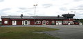
Airfield


Web links
Individual evidence
- ↑ a b Statistiska centralbyrån : Land area per Tatort, folkmängd and invånare per square kilometer. Vart femte år 1960 - 2015 (database query)
Place of the crime: Vilhelmina
Småorter: Dalasjö | Dikanäs | Kittelfjäll | Klimpfjäll | Latikberg | Lövliden | Lövstrand | Malgovik | Meselefors | Nästansjö | Saxnäs | Skansholm
Other places: Storseleby