Ljusnan
| Ljusnan | ||
|
Location of the Ljusnan |
||
| Data | ||
| location | Jämtlands län , Gävleborgs län ( Sweden ) | |
| River system | Ljusnan | |
| source | in the mountains of Skanden | |
| Source height | approx. 1400 m above sea level | |
| muzzle | at Ljusne in the Gulf of Bothnia Coordinates: 61 ° 12 '12 " N , 17 ° 7' 57" E 61 ° 12 '12 " N , 17 ° 7' 57" E |
|
| Mouth height | 0 m o.h. | |
| Height difference | approx. 1400 m | |
| Bottom slope | approx. 3.2 ‰ | |
| length | 439 km | |
| Catchment area | 19,828.1 km² | |
| Drain |
MQ |
230 m³ / s |
| Right tributaries | Voxnan | |
| Communities | Sveg , Ljusdal , Bollnäs | |
|
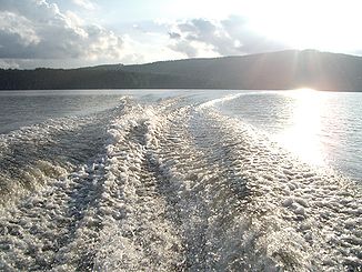
Ljusnan between Arbrå and Vallsta |
||
|
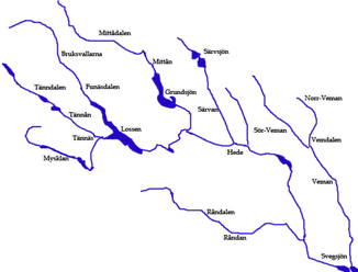
Water system in the upper reaches of the Ljusnan |
||
The Ljusnan River flows through the Swedish provinces of Härjedalen and Hälsingland .
The river has its source in the Scandinavian Mountains west of Ramundberget on Långbrottfjäll not far from the Norwegian border and flows in a south-easterly direction until it flows into the Gulf of Bothnia after about 430 kilometers at Ljusne, 15 kilometers south of Söderhamn . The Ljusnan drains an area of approximately 20,000 km² and the mean water flow is 230 m³ / s. The river forms numerous lakes, including the Lossen , Svegsjön , Vikarsjön , Orsjön , Varpen and Bergviken .
On its course are u. a. the places Sveg , Ljusdal and Bollnäs . The Ljusnan is used to generate electricity, there are 18 hydropower plants on the Ljusnan and one on its largest tributary, the Voxnan . In the past, there was an intensive rafting operation on the river .
Web links
Individual evidence
- ↑ Sveriges Meteorologiska och Hydrologiska Institut (SMHI) - Län och huvudavrinningsområden i Sverige (PDF; 2.5 MB)


