Hafravatn
| Hafravatn | ||
|---|---|---|

|
||
| Geographical location | Iceland | |
| Tributaries | Seljadalsá | |
| Drain | Úlfarsá | |
| Data | ||
| Coordinates | 64 ° 7 ′ 49 ″ N , 21 ° 39 ′ 41 ″ W | |
|
|
||
| Altitude above sea level | 76 m | |
| surface | 1.02 km² | |
| Maximum depth | 28 m | |
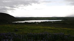
The Hafravatn is a lake in Iceland . It is located around 14 km from the Icelandic capital Reykjavík in the municipality of Mosfellsbær .
geography
The lake is located southeast of the Úlfarsfell palagonite ridge . Lake Langavatn is located southwest of Hafravatn . To the east of the lake is the mountain Hafrahlíð .
The area of Hafravatn is 1.02 km², the lake reaches a maximum depth of 28 m. The lake is fed by the Seljadalsá river . The outflow of the lake is the Úlfarsá .
tourism
Around the shore of the lake there are cottages and the ruins of a sheep pen .
fishes
In the lake you can find char and trout , and rarely salmon .
traffic
Hafravatnsvegur (road 4035) runs along the eastern shore of the lake .
See also
Individual evidence
- ↑ a b c nat.is: Hafravatn ( Memento of the original from June 16, 2011 in the Internet Archive ) Info: The archive link was inserted automatically and has not yet been checked. Please check the original and archive link according to the instructions and then remove this notice.
