Hoo Peninsula
| Hoo | ||
 Hoo Peninsula |
||
| Geographical location | ||
|
|
||
| Coordinates | 51 ° 28 ′ 0 ″ N , 0 ° 30 ′ 0 ″ E | |
| Waters 1 | Thames Estuary ( North Sea ) | |
| Waters 2 | Medway - estuary | |
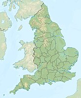
The Hoo Peninsula ( English Hoo Peninsula ) is a peninsula in the unitary authority Medway in England . It lies between the confluences of the Thames and Medway rivers north of the Borough of Medway. The name comes from the old English term for "narrow piece of land".
geography
The peninsula consists of sand and clay hills surrounded by a larger area of marshland . Hoo is considered a paradise for birds and bird lovers.
Places on the Hoo Peninsula
Places on the Hoo Peninsula include Allhallows , Cliffe , Cliffe Woods , Cooling , Grain , High Halstow , Hoo St. Werburgh , St. Mary Hoo, and Stoke .
various
There are several power plants on the peninsula, particularly on the Isle of Grain . A deep-water port, the London Thamesport, has also been built there in recent decades . Cliffe (Kent) is under discussion as the location of a new major airport just outside London.
