Isle of Grain
| Isle of Grain | ||
| Geographical location | ||
|
|
||
| Coordinates | 51 ° 26 '36 " N , 0 ° 41' 48" E | |
| Waters 1 | Thames Estuary | |
| Waters 2 | Medway | |
| length | 5 km | |
| width | 5 km | |
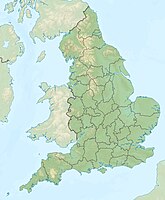
The Isle of Grain is the eastern end of the peninsula Hoo in the north of the county Kent in England . It lies at the mouth of the River Medway in the estuary of the River Thames and consists almost entirely of polders .
At the mouth of Yantlet Creek in the Thames estuary in the north of the peninsula, a London Stone marks the administration of the Thames by the City of London .
The south of the Isle of Grain is now an important industrial area. There was a large oil refinery there until 1982 . Today the London Thamesport is located in this area . Several power plants are located in the vicinity. At its eastern tip is a converter station and the western connection of BritNed ( high-voltage direct current transmission ), a submarine cable to the European mainland to Maasvlakte in the port of Rotterdam .
The Isle of Grain is being discussed as a possible location for a new major airport ( Thames Estuary Airport ), which should relieve the congested London Heathrow Airport and increase the international competitiveness of the region for investors. The British architect Norman Foster presented plans for this in 2011. However, the plan was rejected again in 2014.
Individual evidence
- ↑ Londonist, November 3, 2011: Norman Foster Outlines Thames Estuary Airport Plans
- ↑ London to have the world's largest airport Welt Online, January 8, 2012
- ↑ Deutsche Welle September 2, 2014 ( Memento from September 7, 2014 in the Internet Archive )
