
Maasvlakte

The Maasvlakte ( German Meuse area or Maas level ) is a large industrial and port area in the Dutch city of Rotterdam . It consists of an artificial island south of the Meuse estuary that was created in the 1960s and which was extensively expanded from 2008 to 2013. In addition to several container terminals, there is also a power plant, a logistics center and a terminal for crude oil.
Location and connection
The Maasvlakte is located about 40 km west of Rotterdam city center, but is still part of its municipality. This stretches from the actual core city up the entire area between the Hartelkanaal and Nieuwe Waterweg waterways to the North Sea coast. In the 1950s and 1960s, the Europoort was built on this area , which adjoins the old Rotterdam port facilities to the west. The Maasvlakte, in turn, joins the Europoort to the west.
The Maasvlakte (including the Masvlakte 2 extension) has seven docks : Hartelhaven , Mississippihaven , Amazonehaven , Europahaven , Prinses Arianehaven , Prinses Margriethaven and Prinses Amaliahaven . The last three docks belong to Maasvlakte 2 and are connected to one another via the Yangtze Canal.
The only road connection to the Maasvlakte is the four-lane autoweg N15 , which begins at the Europaweg / Coloradoweg intersection not far from the power station. Shortly before the Suurhoffbrug, this merges into the A15 motorway, which leads to Rotterdam and on to Nijmegen , thus connecting the Maasvlakte and the entire Rotterdam port area to the European trunk road network.
The Betuweroute , a railway line for goods traffic to Zevenaar and further into the Ruhr area, also begins on the Maasvlakte . This runs largely parallel to the A15.
history

At the beginning of the 1960s, the increased number of ocean-going vessels led to the problem that the inland docks of the Europoort could not be reached more and more often or only with long waiting times on the narrow waterways. In addition to the possibility of deepening the navigation channel of the Nieuwe Waterweg, the Dutch government therefore decided in July 1964 to build a deep-water port directly on the North Sea coast.
The proposal drawn up in 1964 by the Vaste Commissie van de Rijksdienst voor het Nationaal Plan to pay attention to nature conservation when the Maasvlakte was filled in was adopted in the planning. In order not to destroy nature at Brielse Gat, it was decided not to build port facilities on the southern section of the Maasvlakte. Rows of dunes were also laid out along the industrial areas. It is noteworthy that, despite the functional character of the Maasvlakte, it has been possible to imitate part of the natural old coastline ( dunes and flat coast ) through particularly sensitive dike management.
The construction of the site began in 1965. Over 50 million m³ of sand (around 200,000 m³ per week) were dredged from the North Sea and the Brielse Gat and poured into the Maasvlakte to a water depth of 22 m below sea level. There are still many fossils in this sand and fossil hunters can often be found. The Oostvoornse Meer lake was created from sand extraction . A northern and a southern dam, consisting of large concrete blocks, shielded the area from the waves of the North Sea. With the closure of the dam in 1968, the area was divided into various port basins and industrial areas for the first time. In 1972 the Maasvlakte Olie Terminal (MOT), an oil port, was created. A year later, in 1973, the coal and ore port Europees Massagoed Overslagbedrijf (EMO) followed. That year the Maasvlakte was officially opened.
Establishments
The main farms on the Maasvlakte are
- Maasvlakte Olie Terminal (MOT), since 1972
- the Europees Massagoed Overslagbedrijf (EMO) for the handling of ores and coal , since 1973
- the Delta Terminal of Europe Container Terminals (ECT), since 1986
- APM Terminals , container terminal of the AP Møller-Mærsk
- the coal and biomass power plant E.ON Benelux
- Lyondellbasell
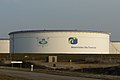
Oil tank of the MOT
Cranes in the EMO

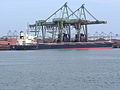
APM terminal

Container handling on the ECT

Power plant on the Maasvlakte


Maasvlakte 2


In 2004, the plans for the Tweede Maasvlakte ("Second Maasvlakte") were approved, which was built further west into the North Sea. The reclamation of new land by flushing began in spring 2008, a good half of the new area (2000 hectares) is used to enlarge the port for terminals and industry, the rest is intended for nature conservation and recreation. The expansion of the Maasvlakte by 20% to 6000 hectares and the new port tripled the handling capacity for containers . This means that the forecasted space requirement should extend to 2030. The costs amount to around three billion euros.
In mid-2007, the last farms allowed to set up on Maasvlakte 2 were selected. The 14 selected companies have set up a consortium under the name Rotterdam World Gateway . The Port of Rotterdam Authority has made it a condition that for the hinterland connection by 2033 at least 45% of the containers will be transported by barge , 20% by rail and only 35% by truck via roads.
The symbolic gap in the eleven kilometer long protective dike around the new peninsula was completed on July 11, 2012 by Queen Beatrix . For the first few years after Maasvlakte 2 went into operation, the market leader ECT fears overcapacity in container loading in Rotterdam. In 2015, the Port of Rotterdam Authority as the client and the companies Royal Boskalis Westminster and Van Oord commissioned by the “Puma” consortium to build the port expansion were awarded by the Dutch Koninklijk Instituut van Ingenieurs the “Prof. Dr. JF Agema Prize ”in the areas of“ Innovation ”and“ Sustainability ”.
The new port has been available for the first partial operation since October 2014. The corresponding port basin has been given the name Prinses Margriethaven , the serial number common in the Netherlands is 8361.
In the Maasvlakte 2 area there are two container terminals from different operator consortia: Rotterdam World Gateway (RWG) (2014) and APM Terminals (APMT) (opening of the automated terminal in February 2015) with a total capacity of around five million TEU . They are also suitable for the currently largest container ships with 19,000 TEU and a draft of up to 20 meters . In addition, an area is planned for the expansion of the Euromax terminal.
See also
Web links
Individual evidence
- ↑ The North Sea becomes Rotterdam . In: Daily port report of July 13, 2012, p. 1/2
- ↑ Eckhard-Herbert Arndt: Award for Rotterdam's Maas Plain 2. In: Daily port report , November 16, 2015.
- ↑ Eckhard-Herbert Arndt: Big pots can come now. Rotterdam's new service port on Maas level 2 is ready for use . In: Daily port report of October 14, 2014, p. 16
- ↑ Hermann Garrelmann: State of the art terminal in the world . In: Hansa , issue 3/2015, p. 83
- ↑ Doubling of capacity with Maasvlakte 2 . In: Daily port report of October 11, 2012, p. 15
Coordinates: 51 ° 57 ′ 9 ″ N , 4 ° 2 ′ 47 ″ E