Hammerleithen
Hammerleithen was a place on the inner-German border that was destroyed in the course of the border security of the GDR.
Hammerleithen is now in the area of the municipality of Eichigt and used to be part of the municipality of Tiefenbrunn . The place was down the slope in a southwestern extension of Pabstleithen between Fuhrbach and Erlbach. Connecting roads lead to Kugelreuth and via Pabstleithen to Tiefenbrunn. The place is close to the German-Czech border and a short distance from the border triangle and the former inner-German border. Like other small border towns, Hammerleithen fell victim to the GDR's border security measures in 1974. In addition to Hammerleithen, the Feilerhaus, trenches in the valley and large parts of Wieden were affected within the former municipality of Tiefenbrunn with a scattered settlement character .
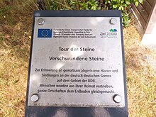
The Hammerleithen rest area with its information is located on the hiking trail to places of fate. The desert areas of Hasenreuth and Troschenreuth are also on the route .
Web links
Individual evidence
- ↑ TK25, sheet 5638 Bobenneukirchen, US Army Map service edition, 1951
- ↑ Report of the inauguration of the hiking trail with map ( PDF ( Memento from June 12, 2018 in the Internet Archive ))
Coordinates: 50 ° 21 ′ 0 ″ N , 12 ° 10 ′ 0 ″ E

